
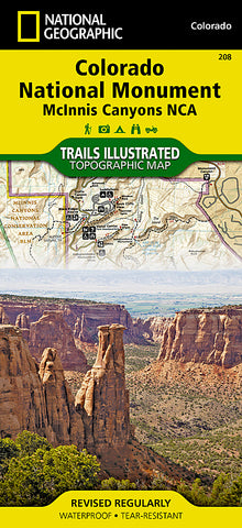

Colorado National Monument/McInnis Canyons, Map 208 by National Geographic Maps
• Waterproof • Tear-Resistant • Topographic Map
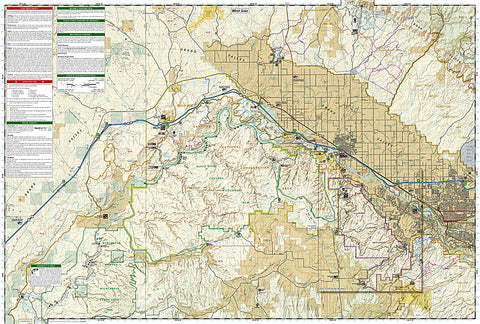
Completely revised and expanded our Colorado National Monument Trails Illustrated map details the high use recreation areas throughout Colorados Grand Valley surrounding the towns of: Grand Junction, Fruita, Palisade, and Loma. This popular region features some of the States most acclaimed mountain biking, hiking and ATV trails including the start of the renowned Kokepelli Trail, which extends down to Moab, UT.
Like all National Geographic Trails Illustrated maps, Colorado National Monument is printed on durable waterproof-tear-resistant material which is designed to stand up to whatever conditions you encounter on the trail.
Coverage Highlights: • Black Ridge Canyons Wilderness • Little Book Cliffs WSA • James E. Robb - Colorado River State Parks • Colorado River Access Points • Westwater, Cisco and Loma Raft Floats • Grand Valley Mountain Bike Trails • Kokopellis Trail • Rattlesnake Arches • OHV Staging Areas and Trails • Bangs Canyon, North Fruita, and East Desert Special Recreation Management Areas • Diamond Dinosaur Prehistoric Highway
- Product Number: 2036807M
- Product Code: TI_COLORADO
- Publisher Product ID: TI00000208
- ISBN: 9781566954013
- Year of Publication: 2008
- Folded Size: 9.45 x 4.330 inches
- Unfolded Size: 24.8 x 37.01 inches
- Map type: Folded Map
- Geographical region: Colorado


