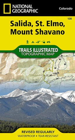
Salida, St. Elmo and Mount Shavano, Colorado, Map 130 by National Geographic Maps
Waterproof, tear-resistant, topographic map of Salida, St. Elmo, and Mt Shavano, CO.
National Geographics Trail Illustrated map of Salida, St. Elmo and Mount Shavano offers extensive detail for outdoor enthusiasts exploring this area in the heart of the San Isabel National Forest. Expertly researched and created in partnership with the U.S. Forest Service, the Bureau of Land Management and others, this map will guide you along the trails, up and down the peaks and across the rivers and lakes as you enjoy your adventure or recreation activity. The map features many points of interest, including North Fork Reservoir, Tabeguache Peak, Mount Princeton and the Collegiate Peaks Byway along with its many recreation areas.
The maps clearly marked trails and trailheads can guide you off the beaten path and back again. Parts of the Continental Divide Trail and Colorado Trail that pass through the area are highlighted on the map as well as mountain bike routes. The map base includes contour lines and elevations for summits, passes, lakes and rivers. Some of the many recreation features noted include ski and snowmobile areas, shooting ranges, river access points and fishing areas, campgrounds and ranger stations.
Every Trails Illustrated map is printed on Backcountry Tough waterproof, tear-resistant paper. A full UTM grid is printed on the map to aid with GPS navigation.
Other features found on this map include: Gunnison National Forest, Mount Antero, Mount Princeton, Mount Shavano, San Isabel National Forest, Tabeguache Peak.
- Product Number: 2034579M
- Product Code: TI_CO_130
- Publisher Product ID: TI00000130
- ISBN: 9781566953504
- Year of Publication: 2008
- Folded Size: 7.48 x 3.94 inches
- Unfolded Size: 26.77 x 20.870 inches
- Map type: Folded Map
- Geographical region: Colorado

