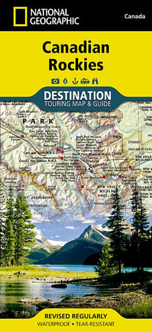
Canadian Rockies DestinationMap
• Waterproof • Tear-Resistant • Travel Map
National Geographics Canadian Rockies Destination Map strikes the perfect balance between map and guidebook and is an ideal resource for touring this culturally and geographically unique region. Canadas share of the Rocky Moutains averages approximately 100 miles across (160 kilometers) and runs from Waterton Lakes National Park on the Alberta-Montana border northwest towards the Yukon territory.
The front side of the Canadian Rockies DestinationMap reveals a map of the Alberta-British Columbia border region in the ranges southern half, which is home to the many beautiful and accessible parks for which the Canadian Rockies are famous. Jasper, Banff, Yoho, Glacier, and Kootenay National Parks are featured as well as a comprehensive road network including the Trans-Canada highway and Icefields Parkway. Indian reserves, provincial parks, protected and natural areas, wilderness, and recreation areas are featured on the map. Photograph
- Product Number: NG_DM_ROCKIES_20
- Reference Product Number: 2059784M
- ISBN: 9781597755139
- Date of Publication: 6/1/2020
- Folded Size: 9.45 inches high by 4.33 inches wide
- Unfolded (flat) Size: 25.59 inches high by 37.01 inches wide
- Map format: Folded
- Map type: Trade Maps - Tourist
- Geographical region: Canada
- Geographical subregion: Alberta,British Columbia