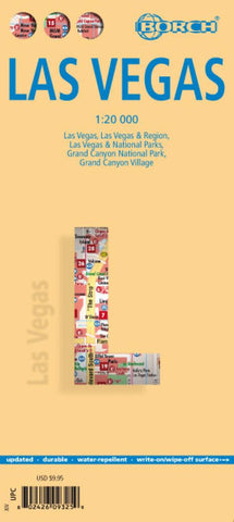
Las Vegas, Nevada City Map
Very clear, indexed tourist street plan of the city on durable, laminated paper, with additional maps of the surrounding area and the Grand Canyon. The main map includes the Strip, Interstate 15 to the west, Downtown, the international airport, and much of the Winchester district east of the Strip. Detail includes one-way streets, casinos, resorts, hotels, shopping malls, pedestrian zones, notable buildings, public buildings, railways and the monorail. Symbols denote landmarks and tourism features such as information centres, car parks, attractions, shows and museums. The map is indexed for streets, casinos, hotels, tourism sites, shopping malls and other notable buildings.
On the reverse is a road map at 1:150,000 of the surrounding region including the city’s northern suburbs, Henderson, Boulder City, Lake Mead and the Hoover Dam. Features indicated by symbols, include golf courses, campsites and marinas. Going further afield, there is a 1:3,000,000 road map showing the natio
- Product Number: BOR_LAS_VE_22
- Reference Product Number: - None -
- ISBN: 9783866093256
- Date of Publication: 6/1/2022
- Folded Size: 9.45 inches high by 4.33 inches wide
- Unfolded (flat) Size: 19.69 inches high by 25.98 inches wide
- Map format: Folded
- Map type: Trade Maps - City Maps
- Geographical region: United States
- Geographical subregion: Nevada