Caribbean Map, Cayman Islands, laminated, 2008 by Frankos Maps Ltd.
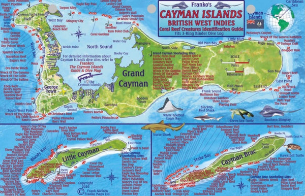
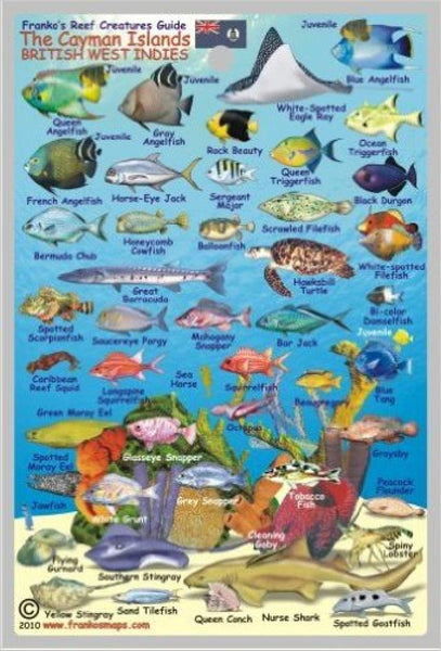
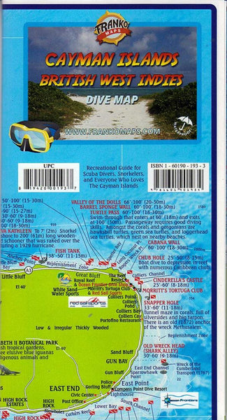
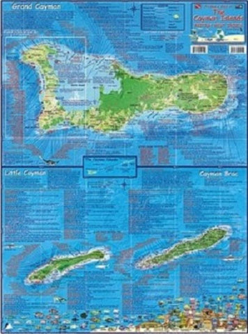
The front side shows Grand Cayman as a separate map, and the Sister Islands, Little Cayman and Cayman Brac, together as another map. Each island is mapped in a unique style that shows the beauty of the island and the surrounding Caribbean Sea. Every detail of the coast can be clearly seen, along with a unique depiction of the bathymetry, so the viewer can visualize how the waters just beyond each islands shore plunges into the deep. This view helps the viewer to see how unusual the Cayman Islands really are, as they rise up from the deep to just above the surface. Map coloring shows you where it is green and covered by thick Cayman forest, or where it is a swampy mangrove, or where it is a city. All of the main roads, as well as a few trails are shown as well, so this is the perfect navigation map as you cruise around in your left-hand-drive rental car. Frankos Map of The Cayman Islands is not just a pretty picture, but it is full of useful information as well. It includes descriptions of and dive flags locating Grand Caymans most notable dive spots, although the West End of Grand Cayman are detailed on side 2 of the map. There are over 150 dive sites shown just on Grand Cayman, and then well over 50 more on each of the Sister Islands. Many of the dive sites also include a few lines of accurate descriptions to represent what might be seen on the dive site. Like other Franko Maps related to islands or coast areas, this includes 100 or so species of the local coral reef creatures that you will most likely see on any given dive or snorkeling excursion.
- Product Number: 2042510M
- Product Code: FM_CAYMAN_LAM
- ISBN: 9781601901941
- Year of Publication: 2008
- Unfolded Size: 25 x 18.31 inches
- Map type: Flat Map
- Geographical region: Cayman Islands