
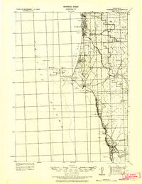
~ Crescent City CA topo map, 1:125000 scale, 30 X 30 Minute, Historical, 1929, updated 1929
Crescent City, California, USGS topographic map dated 1929.
Includes geographic coordinates (latitude and longitude). This topographic map is suitable for hiking, camping, and exploring, or framing it as a wall map.
Printed on-demand using high resolution imagery, on heavy weight and acid free paper, or alternatively on a variety of synthetic materials.
Topos available on paper, Waterproof, Poly, or Tyvek. Usually shipping rolled, unless combined with other folded maps in one order.
- Product Number: USGS-5688442
- Free digital map download (high-resolution, GeoPDF): Crescent City, California (file size: 5 MB)
- Map Size: please refer to the dimensions of the GeoPDF map above
- Weight (paper map): ca. 55 grams
- Map Type: POD USGS Topographic Map
- Map Series: HTMC
- Map Verison: Historical
- Cell ID: 396070
- Scan ID: 299307
- Imprint Year: 1929
- Survey Year: 1921
- Datum: Unstated
- Map Projection: Unstated
- Map published by United States Army Corps of Engineers
- Keywords: Nonstandard Press Run
- Map Language: English
- Scanner Resolution: 600 dpi
- Map Cell Name: Crescent City
- Grid size: 30 X 30 Minute
- Date on map: 1929
- Map Scale: 1:125000
- Geographical region: California, United States
Neighboring Maps:
All neighboring USGS topo maps are available for sale online at a variety of scales.
Spatial coverage:
Topo map Crescent City, California, covers the geographical area associated the following places:
- False Klamath - Douglas Park - Yontocket - Klamath - Tatlatunne (historical) - Khwunrghunme (historical) - Khoonkhwuttunne (historical) - Camp Klamath - Tryon Corner - Pacific Shores - Crescent City - Fort Dick - Hoppaw - Waukell Flat (historical) - Rekwoi (historical) - Requa - Smith River - Hiouchi
- Map Area ID: AREA4241.5-124.5-124
- Northwest corner Lat/Long code: USGSNW42-124.5
- Northeast corner Lat/Long code: USGSNE42-124
- Southwest corner Lat/Long code: USGSSW41.5-124.5
- Southeast corner Lat/Long code: USGSSE41.5-124
- Northern map edge Latitude: 42
- Southern map edge Latitude: 41.5
- Western map edge Longitude: -124.5
- Eastern map edge Longitude: -124


