
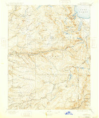
~ Pyramid Peak CA topo map, 1:125000 scale, 30 X 30 Minute, Historical, 1896, updated 1932
Pyramid Peak, California, USGS topographic map dated 1896.
Includes geographic coordinates (latitude and longitude). This topographic map is suitable for hiking, camping, and exploring, or framing it as a wall map.
Printed on-demand using high resolution imagery, on heavy weight and acid free paper, or alternatively on a variety of synthetic materials.
Topos available on paper, Waterproof, Poly, or Tyvek. Usually shipping rolled, unless combined with other folded maps in one order.
- Product Number: USGS-5647649
- Free digital map download (high-resolution, GeoPDF): Pyramid Peak, California (file size: 9 MB)
- Map Size: please refer to the dimensions of the GeoPDF map above
- Weight (paper map): ca. 55 grams
- Map Type: POD USGS Topographic Map
- Map Series: HTMC
- Map Verison: Historical
- Cell ID: 66411
- Scan ID: 299570
- Imprint Year: 1932
- Survey Year: 1889
- Datum: Unstated
- Map Projection: Polyconic
- Map published by United States Geological Survey
- Map Language: English
- Scanner Resolution: 600 dpi
- Map Cell Name: Pyramid Peak
- Grid size: 30 X 30 Minute
- Date on map: 1896
- Map Scale: 1:125000
- Geographical region: California, United States
Neighboring Maps:
All neighboring USGS topo maps are available for sale online at a variety of scales.
Spatial coverage:
Topo map Pyramid Peak, California, covers the geographical area associated the following places:
- Short Place - Spring Creek - Jones Place - Kirkwood - McConnel Place - Emerald Bay - Sciots Camp - Meyers - Riverton - Phillips - Tragedy Spring (historical) - Twin Bridges - Pilliken - Lower Forni - Morrison - Tahoe Valley - Raffetto - Little Norway - Kiva Beach - Allen - Nebelhorn - Croft - Plasse - Tahoe Keys - White Hall - Kyburz - Kit Carson - Bryants - Dew Drop (historical) - Echo Lake - Upper Forni - Voss - Griminger - Meiss - Strawberry - Darlington - Gilberts - Lake Valley - Camp Richardson - Bonetti - Fallen Leaf - Tallac Village - Caldor
- Map Area ID: AREA3938.5-120.5-120
- Northwest corner Lat/Long code: USGSNW39-120.5
- Northeast corner Lat/Long code: USGSNE39-120
- Southwest corner Lat/Long code: USGSSW38.5-120.5
- Southeast corner Lat/Long code: USGSSE38.5-120
- Northern map edge Latitude: 39
- Southern map edge Latitude: 38.5
- Western map edge Longitude: -120.5
- Eastern map edge Longitude: -120


