
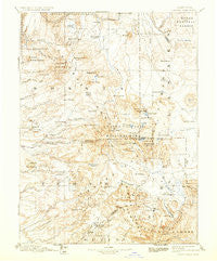
~ Lassen Peak CA topo map, 1:250000 scale, 1 X 1 Degree, Historical, 1894, updated 1933
Lassen Peak, California, USGS topographic map dated 1894.
Includes geographic coordinates (latitude and longitude). This topographic map is suitable for hiking, camping, and exploring, or framing it as a wall map.
Printed on-demand using high resolution imagery, on heavy weight and acid free paper, or alternatively on a variety of synthetic materials.
Topos available on paper, Waterproof, Poly, or Tyvek. Usually shipping rolled, unless combined with other folded maps in one order.
- Product Number: USGS-5618472
- Free digital map download (high-resolution, GeoPDF): Lassen Peak, California (file size: 8 MB)
- Map Size: please refer to the dimensions of the GeoPDF map above
- Weight (paper map): ca. 55 grams
- Map Type: POD USGS Topographic Map
- Map Series: HTMC
- Map Verison: Historical
- Cell ID: 322495
- Scan ID: 299807
- Imprint Year: 1933
- Survey Year: 1884
- Datum: Unstated
- Map Projection: Polyconic
- Map published by United States Geological Survey
- Map Language: English
- Scanner Resolution: 600 dpi
- Map Cell Name: Susanville W
- Grid size: 1 X 1 Degree
- Date on map: 1894
- Map Scale: 1:250000
- Geographical region: California, United States
Neighboring Maps:
All neighboring USGS topo maps are available for sale online at a variety of scales.
Spatial coverage:
Topo map Lassen Peak, California, covers the geographical area associated the following places:
- Favinger Place - Saint Bernard - Montgomery Creek - Dantuma Place - Tenmile (historical) - Almanor - Morgan Springs - Lake Almanor Peninsula - Deer Creek - Eastman Place - Westwood - Peligreen Place - Marian Place - Lake Almanor Country Club - Drakesbad - Butte Meadows - Twain - Jellico - Mineral - Finley Place - Paynes Creek - Shingletown - Meyers Place - Dixie - Avery Place - Cassel - Wade Place - Black Forest - Manton - Facht Place - Robbers Creek - Savercool Place - Four Corners - Lake Almanor West - Haven - Inwood - Peninsula Village - Payne Place - Halls Flat - Summertown - Lyonsville - Summerville (historical) - Wells Place - Yellowjacket - Longville - Virgilia - Four Corners - Campbellville - Roberts Place - Canyondam - Little Valley - Old Station - Prattville - Doyles Corner - Mill Creek - Whittington Place - Clear Creek - Midway - Caribou - Beal Place - Jonesville - Hat Creek - Chester - Buena Vista - Redwoods - Round Mountain - Grays Flat - Fern - East Shore - Thompson Place - Viola - Hamilton Branch - McKenzie Place - Norvell - Seneca - Burney - Hot Springs - Lomo - Polk Springs - Childs Meadows - Foxwood - Bateman Place - Wengler - Pape Place - Manzanita Lake - Lyman Springs - Hillcrest - McClure Place - Glenburn - Las Colinas Mobile Home Park - Johnson Park - Belden - Whitmore
- Map Area ID: AREA4140-122-121
- Northwest corner Lat/Long code: USGSNW41-122
- Northeast corner Lat/Long code: USGSNE41-121
- Southwest corner Lat/Long code: USGSSW40-122
- Southeast corner Lat/Long code: USGSSE40-121
- Northern map edge Latitude: 41
- Southern map edge Latitude: 40
- Western map edge Longitude: -122
- Eastern map edge Longitude: -121


