
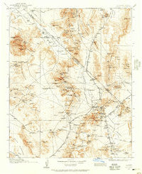
~ Ivanpah CA topo map, 1:250000 scale, 1 X 1 Degree, Historical, 1910, updated 1957
Ivanpah, California, USGS topographic map dated 1910.
Includes geographic coordinates (latitude and longitude). This topographic map is suitable for hiking, camping, and exploring, or framing it as a wall map.
Printed on-demand using high resolution imagery, on heavy weight and acid free paper, or alternatively on a variety of synthetic materials.
Topos available on paper, Waterproof, Poly, or Tyvek. Usually shipping rolled, unless combined with other folded maps in one order.
- Product Number: USGS-5618446
- Free digital map download (high-resolution, GeoPDF): Ivanpah, California (file size: 9 MB)
- Map Size: please refer to the dimensions of the GeoPDF map above
- Weight (paper map): ca. 55 grams
- Map Type: POD USGS Topographic Map
- Map Series: HTMC
- Map Verison: Historical
- Cell ID: 322219
- Scan ID: 299793
- Imprint Year: 1957
- Survey Year: 1910
- Datum: Unstated
- Map Projection: Polyconic
- Map published by United States Geological Survey
- Map Language: English
- Scanner Resolution: 600 dpi
- Map Cell Name: Kingman W
- Grid size: 1 X 1 Degree
- Date on map: 1910
- Map Scale: 1:250000
- Geographical region: California, United States
Neighboring Maps:
All neighboring USGS topo maps are available for sale online at a variety of scales.
Spatial coverage:
Topo map Ivanpah, California, covers the geographical area associated the following places:
- Ripley - Rainbow Wells - Jean - Vanderbilt - Lanfair - Platina (historical) - Calada - Morgantown (historical) - Kelso - Chase - Mountain Pass - Sands - Primm - Root Camp (historical) - Mandolin (historical) - Bard - Borax - Sloan - Hayden - Crescent (historical) - Moore - Nipton - Sandy Valley - Brant - Lincoln City - Ivanpah - Wheaton Springs - Barnwell - Joshua - Halloran Springs - Valley Wells Station - Elora - Goodsprings - Sandy Mill - Juan - Thomas Place - Roach - Hart (historical) - Erie - Calvada Springs - Yucca Grove - Cima
- Map Area ID: AREA3635-116-115
- Northwest corner Lat/Long code: USGSNW36-116
- Northeast corner Lat/Long code: USGSNE36-115
- Southwest corner Lat/Long code: USGSSW35-116
- Southeast corner Lat/Long code: USGSSE35-115
- Northern map edge Latitude: 36
- Southern map edge Latitude: 35
- Western map edge Longitude: -116
- Eastern map edge Longitude: -115


