
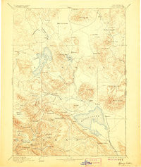
~ Honey Lake CA topo map, 1:250000 scale, 1 X 1 Degree, Historical, 1893, updated 1906
Honey Lake, California, USGS topographic map dated 1893.
Includes geographic coordinates (latitude and longitude). This topographic map is suitable for hiking, camping, and exploring, or framing it as a wall map.
Printed on-demand using high resolution imagery, on heavy weight and acid free paper, or alternatively on a variety of synthetic materials.
Topos available on paper, Waterproof, Poly, or Tyvek. Usually shipping rolled, unless combined with other folded maps in one order.
- Product Number: USGS-5618434
- Free digital map download (high-resolution, GeoPDF): Honey Lake, California (file size: 7 MB)
- Map Size: please refer to the dimensions of the GeoPDF map above
- Weight (paper map): ca. 55 grams
- Map Type: POD USGS Topographic Map
- Map Series: HTMC
- Map Verison: Historical
- Cell ID: 322494
- Scan ID: 299787
- Imprint Year: 1906
- Survey Year: 1882
- Datum: Unstated
- Map Projection: Unstated
- Map published by United States Geological Survey
- Map Language: English
- Scanner Resolution: 600 dpi
- Map Cell Name: Susanville E
- Grid size: 1 X 1 Degree
- Date on map: 1893
- Map Scale: 1:250000
- Geographical region: California, United States
Neighboring Maps:
All neighboring USGS topo maps are available for sale online at a variety of scales.
Spatial coverage:
Topo map Honey Lake, California, covers the geographical area associated the following places:
- Shumway - Spalding Tract - Doyle - Leavitt - Viewland - Crest - Brockman - Round Valley (historical) - Litchfield - Belfast - Crescent Mills - Ravendale - Horse Lake - Karlo - Moran - Coppervale - Keddie - Sheepshead - Indian Falls - Milford - Hayden Hill - Westwood Junction - The Crossing - Greenville - Edgemont (historical) - Standish - Tasikoyo (historical) - Patton Village - Herlong Junction - Johnstonville - Paxton - Lasco - Janesville - Stacy - Moccasin - Pine Town - Stones Landing - Buntingville - Herlong - Genesee - Termo - Calneva - Goumaz (historical) - Taylorsville - Susanville - Wendel
- Map Area ID: AREA4140-121-120
- Northwest corner Lat/Long code: USGSNW41-121
- Northeast corner Lat/Long code: USGSNE41-120
- Southwest corner Lat/Long code: USGSSW40-121
- Southeast corner Lat/Long code: USGSSE40-120
- Northern map edge Latitude: 41
- Southern map edge Latitude: 40
- Western map edge Longitude: -121
- Eastern map edge Longitude: -120


