
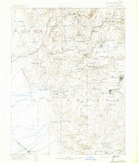
~ Smartsville CA topo map, 1:125000 scale, 30 X 30 Minute, Historical, 1891, updated 1891
Smartsville, California, USGS topographic map dated 1891.
Includes geographic coordinates (latitude and longitude). This topographic map is suitable for hiking, camping, and exploring, or framing it as a wall map.
Printed on-demand using high resolution imagery, on heavy weight and acid free paper, or alternatively on a variety of synthetic materials.
Topos available on paper, Waterproof, Poly, or Tyvek. Usually shipping rolled, unless combined with other folded maps in one order.
- Product Number: USGS-5506323
- Free digital map download (high-resolution, GeoPDF): Smartsville, California (file size: 7 MB)
- Map Size: please refer to the dimensions of the GeoPDF map above
- Weight (paper map): ca. 55 grams
- Map Type: POD USGS Topographic Map
- Map Series: HTMC
- Map Verison: Historical
- Cell ID: 66649
- Scan ID: 299640
- Imprint Year: 1891
- Survey Year: 1886
- Datum: Unstated
- Map Projection: Unstated
- Map published by United States Geological Survey
- Map Language: English
- Scanner Resolution: 600 dpi
- Map Cell Name: Smartsville
- Grid size: 30 X 30 Minute
- Date on map: 1891
- Map Scale: 1:125000
- Geographical region: California, United States
Neighboring Maps:
All neighboring USGS topo maps are available for sale online at a variety of scales.
Spatial coverage:
Topo map Smartsville, California, covers the geographical area associated the following places:
- Meadow Vista - Casey Corner - Banner Crest - Nevada City - Sahl Court - Timbuctoo - Greenville - Garden Valley (historical) - Dobbins - Echo Ridge Trails - Union Hill - Grass Valley - Sicard Flat - Sierra Vista Park - Lake of the Pines - Kres - Galena Hill (historical) - Cedar Ridge - Condemned Bar (historical) - La Barr Meadows - Newtown - Highland Park - Sunrise Heights - Olympia Glade - Foster Bar (historical) - Oak Grove (historical) - Challenge - Wolf - Rackerby - Bridgeport - Hammonton - Boston Ravine - Timber Trails - Ophir Hill Acres - Camptonville - Stanfield Hill - Champion (historical) - Shelby Flat (historical) - Horstville - Rancho Loma Rica - Kenwood Estates - The Oaks - Cherry Creek Acres - Bella Vista Park - Spring Hill - Aero Pines Mobile Home Park - Birchville - Swedes Flat (historical) - Glenbrook - Alta Hill - Mooney Flat - Iowa City - Higgins Corner - Oak Valley - Waldo Junction - Gold Flat - Bitney Corner - Frenchtown - Sharon Valley - Olive Hill - Big Oak Valley - Wheatland - Willaura Estates - Dew Drop - Frenches Ravine (historical) - Brownsville - Alta Vista Park - White Spot - Lake Wildwood - Leduc Acres - Sucker Flat - Badger Hill (historical) - Sebastopol - Jones Bar (historical) - Rough and Ready - Cypress Hill - French Corral - Oregon House - Bangor - Forest Spring (historical) - Alta Sierra Estates - Sunset View - Wyandotte - Evergreen Estates - Smartsville - Providence (historical) - Town Talk - Cherokee - Ridge View - Birch Meadow Acres - Loma Rica - Pinewood Mobile Home Park - Sherwood Forest - Cedar Crest - Browns Valley - Marigold (historical) - Hills Flat - Alta Sierra - Forest Knolls - Bullards Bar (historical)
- Map Area ID: AREA39.539-121.5-121
- Northwest corner Lat/Long code: USGSNW39.5-121.5
- Northeast corner Lat/Long code: USGSNE39.5-121
- Southwest corner Lat/Long code: USGSSW39-121.5
- Southeast corner Lat/Long code: USGSSE39-121
- Northern map edge Latitude: 39.5
- Southern map edge Latitude: 39
- Western map edge Longitude: -121.5
- Eastern map edge Longitude: -121


