
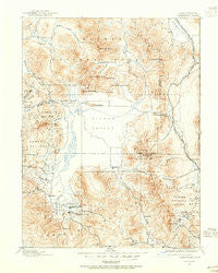
~ Sierraville CA topo map, 1:125000 scale, 30 X 30 Minute, Historical, 1890, updated 1955
Sierraville, California, USGS topographic map dated 1890.
Includes geographic coordinates (latitude and longitude). This topographic map is suitable for hiking, camping, and exploring, or framing it as a wall map.
Printed on-demand using high resolution imagery, on heavy weight and acid free paper, or alternatively on a variety of synthetic materials.
Topos available on paper, Waterproof, Poly, or Tyvek. Usually shipping rolled, unless combined with other folded maps in one order.
- Product Number: USGS-5506315
- Free digital map download (high-resolution, GeoPDF): Sierraville, California (file size: 9 MB)
- Map Size: please refer to the dimensions of the GeoPDF map above
- Weight (paper map): ca. 55 grams
- Map Type: POD USGS Topographic Map
- Map Series: HTMC
- Map Verison: Historical
- Cell ID: 66628
- Scan ID: 302077
- Imprint Year: 1955
- Survey Year: 1890
- Datum: Unstated
- Map Projection: Polyconic
- Map published by United States Geological Survey
- Map Language: English
- Scanner Resolution: 600 dpi
- Map Cell Name: Sierraville
- Grid size: 30 X 30 Minute
- Date on map: 1890
- Map Scale: 1:125000
- Geographical region: California, United States
Neighboring Maps:
All neighboring USGS topo maps are available for sale online at a variety of scales.
Spatial coverage:
Topo map Sierraville, California, covers the geographical area associated the following places:
- Scotts - Delleker - Chilcoot - Hawley - Lake Davis - Portola - Iron Horse - Sattley - Chats (historical) - Crow (historical) - Sierraville - Beckwourth - Vinton - Constantia - Antelope (historical) - Hallelujah Junction - Sierra Brooks - Verdi - Omira - Campbell Hot Springs - Kerby (historical) - Calpine - Plumas - Peavine - Loyalton - Randolph - Sierra Pines - Reno Junction
- Map Area ID: AREA4039.5-120.5-120
- Northwest corner Lat/Long code: USGSNW40-120.5
- Northeast corner Lat/Long code: USGSNE40-120
- Southwest corner Lat/Long code: USGSSW39.5-120.5
- Southeast corner Lat/Long code: USGSSE39.5-120
- Northern map edge Latitude: 40
- Southern map edge Latitude: 39.5
- Western map edge Longitude: -120.5
- Eastern map edge Longitude: -120


