
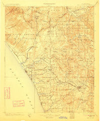
~ San Luis Rey CA topo map, 1:125000 scale, 30 X 30 Minute, Historical, 1901, updated 1911
San Luis Rey, California, USGS topographic map dated 1901.
Includes geographic coordinates (latitude and longitude). This topographic map is suitable for hiking, camping, and exploring, or framing it as a wall map.
Printed on-demand using high resolution imagery, on heavy weight and acid free paper, or alternatively on a variety of synthetic materials.
Topos available on paper, Waterproof, Poly, or Tyvek. Usually shipping rolled, unless combined with other folded maps in one order.
- Product Number: USGS-5506261
- Free digital map download (high-resolution, GeoPDF): San Luis Rey, California (file size: 8 MB)
- Map Size: please refer to the dimensions of the GeoPDF map above
- Weight (paper map): ca. 55 grams
- Map Type: POD USGS Topographic Map
- Map Series: HTMC
- Map Verison: Historical
- Cell ID: 66548
- Scan ID: 299615
- Imprint Year: 1911
- Survey Year: 1898
- Datum: Unstated
- Map Projection: Unstated
- Map published by United States Geological Survey
- Map Language: English
- Scanner Resolution: 600 dpi
- Map Cell Name: San Luis Rey
- Grid size: 30 X 30 Minute
- Date on map: 1901
- Map Scale: 1:125000
- Geographical region: California, United States
Neighboring Maps:
All neighboring USGS topo maps are available for sale online at a variety of scales.
Spatial coverage:
Topo map San Luis Rey, California, covers the geographical area associated the following places:
- Laguna Vista Trailer Park - Temecula - Green Valley Mobile Estates - Bonsall - Friendly Hills Manor Mobile Home Park - Oak Haven Estates - Jesmond Dene - Leucadia - Riviera Mobile Home Park - Villa Madeira Mobile Home Park - Las Flores - Madrid Manor Mobile Home Park - Encinitas - Cardiff-by-the-Sea - Park Encinitas Trailer Park - El Camino 76 Trailer Park - Twin Oaks - Rancho Carlsbad Trailer Park - Pala Mesa - Carefree Ranch Mobile Home Park - Lilac - Ysidora (historical) - Talich - Rainbow Canyon Village - Fallbrook - Rancho Calevero Mobile Home Park - Valley Center - Rancho San Luis Rey Trailer Park - Lawrence Welk Resort Village - San Luis Rey - Sundance Mobile Home Park - LaMoree Mobile Estates - Stuart - Vista Manor Trailer Park - Richland - Gold Star Mobile Home - Carlsbad - The Palms Trailer Park - Buena - Greencrest Park Mobile Home Park - Foothills of San Marcos Mobile Home Park - Mobile Park West Mobile Home Park - Lanaki Lane Mobile Home Park - Temecula Ranchos - Vista Verde Estates Mobile Home Park - Windsor Crest - Casa Grande Estates Mobile Home Park - Sierra Vista Trailer Park - Palomar Park Mobile Home Park - Bellview Park Mobile Home Park - Fallbrook Junction - Don (historical) - Rancho Santa Fe - Hidden Vale Mobile Home Park - Moonglow Mobile Home Park - Oceanside - Lake San Marcos - Ponderosa Club Mobile Home Park - Lake Bernardo Estates Mobile Home Park - Lake Village - Carlsbad Trailer Park - Escondido - DeLuz - Rancho Escondido Mobile Home Park - Vista Cascade Mobile Home Park - Ivy del Mobile Home Park - Harmony Grove - Farr - Pala - Del Dios - Escondido Terrace Mobile Home Park - De Luz - De Luz Heights - Citrus Gardens Mobile Home Park - Casa de Amigos Mobile Home Park - The Views Mobile Home Park - Trico Mobile Estates - Rancho Bernardo - Winterwarm - Sycamore Creek Mobile Home Park - Vista - Rainbow - Sunset Terrace Mobile Home Park - Colina Vista - Yaldora - San Luis Rey Heights - Tiki Mobile Village - Los Ranchitos - South Oceanside - Sea Aire Mobile Home Park - La Costa - Jofegan - Hidden Meadows - Palomar East Mobile Home Park - Green Valley - Olivenhain - San Marcos - Green Tree Estates Mobile Home Park - Santa Margarita Groves - Chappo
- Map Area ID: AREA33.533-117.5-117
- Northwest corner Lat/Long code: USGSNW33.5-117.5
- Northeast corner Lat/Long code: USGSNE33.5-117
- Southwest corner Lat/Long code: USGSSW33-117.5
- Southeast corner Lat/Long code: USGSSE33-117
- Northern map edge Latitude: 33.5
- Southern map edge Latitude: 33
- Western map edge Longitude: -117.5
- Eastern map edge Longitude: -117


