
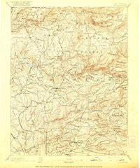
~ Placerville CA topo map, 1:125000 scale, 30 X 30 Minute, Historical, 1893, updated 1921
Placerville, California, USGS topographic map dated 1893.
Includes geographic coordinates (latitude and longitude). This topographic map is suitable for hiking, camping, and exploring, or framing it as a wall map.
Printed on-demand using high resolution imagery, on heavy weight and acid free paper, or alternatively on a variety of synthetic materials.
Topos available on paper, Waterproof, Poly, or Tyvek. Usually shipping rolled, unless combined with other folded maps in one order.
- Product Number: USGS-5506137
- Free digital map download (high-resolution, GeoPDF): Placerville, California (file size: 10 MB)
- Map Size: please refer to the dimensions of the GeoPDF map above
- Weight (paper map): ca. 55 grams
- Map Type: POD USGS Topographic Map
- Map Series: HTMC
- Map Verison: Historical
- Cell ID: 66349
- Scan ID: 299550
- Imprint Year: 1921
- Survey Year: 1887
- Datum: Unstated
- Map Projection: Unstated
- Map published by United States Geological Survey
- Map Language: English
- Scanner Resolution: 600 dpi
- Map Cell Name: Placerville
- Grid size: 30 X 30 Minute
- Date on map: 1893
- Map Scale: 1:125000
- Geographical region: California, United States
Neighboring Maps:
All neighboring USGS topo maps are available for sale online at a variety of scales.
Spatial coverage:
Topo map Placerville, California, covers the geographical area associated the following places:
- Van Vleck - Grizzly Peak - Fiddletown - Gold Ridge - Deer Park - Greenwood - Cedar Grove - Campana - Fair Play - Shingle Springs - Latrobe - Diamond Springs - Fornis - Happy Valley - Aukum - McManus - Apex - Sly Park - Kingsville - Brela - Balderson Station - Camino - Zuver - Bullard - Somerset - Outingdale - Newtown - Pollock Pines - Smithflat - Avinsino Corner - Mariemont - McCulloh - Cedar Grove - Fresh Pond - Cameron Airpark Estates - Sierra Springs - Flonellis - Volcanoville - Spanish Flat - Camino Heights - Five Mile Terrace - Koloma (historical) - Lotus - Brandon Corner - North Placerville - Tiger Lily - Gold Hill - Buckeye - Deer View - Dugan - Spring Valley - Perks Corner - Old Pino - Claussenius - River Pines - Ditch Camp Five - Pleasant Valley - Melsons Corner - Meadow Brook - Chili Bar - Ramsey Crossing - Sweeneys Crossing - Placerville - Leonardi - Coloma - Todd Valley - Auburn Lake Trails - Pacific - Sprekelsville - Frenchtown - Motor City - Buckeye Flat (historical) - Pino Grande - Jayhawk - Skinners - Lakewood Sierra - Bamom (historical) - Buffalo Hill - Cold Springs - Kelsey - Cameron Park - Tylers Corner - Shrub - Georgetown - Coyoteville - El Dorado - Nashville - Garden Valley - Old Fort Jim - Quintette - Gold Trail Park - Grizzly Flat - Rancho del Sol - Fairbanks - Enterprise - Indak (historical) - Soapweed - Omo Ranch
- Map Area ID: AREA3938.5-121-120.5
- Northwest corner Lat/Long code: USGSNW39-121
- Northeast corner Lat/Long code: USGSNE39-120.5
- Southwest corner Lat/Long code: USGSSW38.5-121
- Southeast corner Lat/Long code: USGSSE38.5-120.5
- Northern map edge Latitude: 39
- Southern map edge Latitude: 38.5
- Western map edge Longitude: -121
- Eastern map edge Longitude: -120.5


