
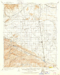
~ Elizabeth Lake CA topo map, 1:125000 scale, 30 X 30 Minute, Historical, 1915, updated 1915
Elizabeth Lake, California, USGS topographic map dated 1915.
Includes geographic coordinates (latitude and longitude). This topographic map is suitable for hiking, camping, and exploring, or framing it as a wall map.
Printed on-demand using high resolution imagery, on heavy weight and acid free paper, or alternatively on a variety of synthetic materials.
Topos available on paper, Waterproof, Poly, or Tyvek. Usually shipping rolled, unless combined with other folded maps in one order.
- Product Number: USGS-5505799
- Free digital map download (high-resolution, GeoPDF): Elizabeth Lake, California (file size: 7 MB)
- Map Size: please refer to the dimensions of the GeoPDF map above
- Weight (paper map): ca. 55 grams
- Map Type: POD USGS Topographic Map
- Map Series: HTMC
- Map Verison: Historical
- Cell ID: 65419
- Scan ID: 299347
- Imprint Year: 1915
- Survey Year: 1915
- Datum: NAD
- Map Projection: Polyconic
- Map published by United States Geological Survey
- Map Language: English
- Scanner Resolution: 600 dpi
- Map Cell Name: Elizabeth Lake
- Grid size: 30 X 30 Minute
- Date on map: 1915
- Map Scale: 1:125000
- Geographical region: California, United States
Neighboring Maps:
All neighboring USGS topo maps are available for sale online at a variety of scales.
Spatial coverage:
Topo map Elizabeth Lake, California, covers the geographical area associated the following places:
- Actis - Vincent - Oban - Green Valley - Bissell - Lake Hughes - White Heather - Boiling Point - Fairmont - Pearland - Lakeview - Rancho Vista - Antelope Acres - Lincoln Crest - Andrade Corner - Eaires (historical) - Avenue E Trailer Park - Four Points - Sunrise - Alpine - Del Sur - The Oaks - Las Cantilles - Roosevelt - Sierra Villa Mobile Home Park - Willow Springs - Palmdale - Desert View Highlands - Sleepy Valley - Harold - Ansel - Mission - Leona Valley - Rosamond - Gloster - Lancaster - Quartz Hill
- Map Area ID: AREA3534.5-118.5-118
- Northwest corner Lat/Long code: USGSNW35-118.5
- Northeast corner Lat/Long code: USGSNE35-118
- Southwest corner Lat/Long code: USGSSW34.5-118.5
- Southeast corner Lat/Long code: USGSSE34.5-118
- Northern map edge Latitude: 35
- Southern map edge Latitude: 34.5
- Western map edge Longitude: -118.5
- Eastern map edge Longitude: -118


