
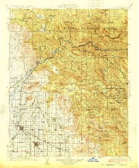
~ Dinuba CA topo map, 1:125000 scale, 30 X 30 Minute, Historical, 1924, updated 1924
Dinuba, California, USGS topographic map dated 1924.
Includes geographic coordinates (latitude and longitude). This topographic map is suitable for hiking, camping, and exploring, or framing it as a wall map.
Printed on-demand using high resolution imagery, on heavy weight and acid free paper, or alternatively on a variety of synthetic materials.
Topos available on paper, Waterproof, Poly, or Tyvek. Usually shipping rolled, unless combined with other folded maps in one order.
- Product Number: USGS-5505757
- Free digital map download (high-resolution, GeoPDF): Dinuba, California (file size: 11 MB)
- Map Size: please refer to the dimensions of the GeoPDF map above
- Weight (paper map): ca. 55 grams
- Map Type: POD USGS Topographic Map
- Map Series: HTMC
- Map Verison: Historical
- Cell ID: 65360
- Scan ID: 299324
- Imprint Year: 1924
- Woodland Tint: Yes
- Survey Year: 1921
- Datum: NAD
- Map Projection: Polyconic
- Map published by United States Geological Survey
- Map Language: English
- Scanner Resolution: 600 dpi
- Map Cell Name: Dinuba
- Grid size: 30 X 30 Minute
- Date on map: 1924
- Map Scale: 1:125000
- Geographical region: California, United States
Neighboring Maps:
All neighboring USGS topo maps are available for sale online at a variety of scales.
Spatial coverage:
Topo map Dinuba, California, covers the geographical area associated the following places:
- Ivory - East Orosi - Deer Crossing - Ellis Place - Avocado - Crabtree - Sultana - Smyrna (historical) - Millwood (historical) - Minkler - Wimp - Pinehurst - Wyeth - Elk - Cella - North Dinuba - Tokay - Primero (historical) - Uva - Squaw Valley - Auckland - Dinuba - Etheda Springs - Rodgers Crossing - Wahtoke - Hoffman Point - Cedarbrook - Centerville - Enson - Gravesboro - Sawmill Flat - Sierra Glen - Badger - Piedra - Goodmill - Orange Cove - Miramonte - Reedley - Delft Colony - Navelencia - Trimmer - Balch Camp - Oakhurst (historical) - Lacjac - Dunlap - Orosi - Cutler - Sentinel (historical)
- Map Area ID: AREA3736.5-119.5-119
- Northwest corner Lat/Long code: USGSNW37-119.5
- Northeast corner Lat/Long code: USGSNE37-119
- Southwest corner Lat/Long code: USGSSW36.5-119.5
- Southeast corner Lat/Long code: USGSSE36.5-119
- Northern map edge Latitude: 37
- Southern map edge Latitude: 36.5
- Western map edge Longitude: -119.5
- Eastern map edge Longitude: -119


