
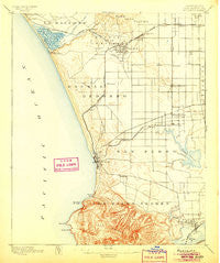
~ Redondo CA topo map, 1:62500 scale, 15 X 15 Minute, Historical, 1896, updated 1905
Redondo, California, USGS topographic map dated 1896.
Includes geographic coordinates (latitude and longitude). This topographic map is suitable for hiking, camping, and exploring, or framing it as a wall map.
Printed on-demand using high resolution imagery, on heavy weight and acid free paper, or alternatively on a variety of synthetic materials.
Topos available on paper, Waterproof, Poly, or Tyvek. Usually shipping rolled, unless combined with other folded maps in one order.
- Product Number: USGS-5503961
- Free digital map download (high-resolution, GeoPDF): Redondo, California (file size: 6 MB)
- Map Size: please refer to the dimensions of the GeoPDF map above
- Weight (paper map): ca. 55 grams
- Map Type: POD USGS Topographic Map
- Map Series: HTMC
- Map Verison: Historical
- Cell ID: 61528
- Scan ID: 298755
- Imprint Year: 1905
- Survey Year: 1894
- Datum: Unstated
- Map Projection: Unstated
- Map published by United States Geological Survey
- Map Language: English
- Scanner Resolution: 600 dpi
- Map Cell Name: Redondo
- Grid size: 15 X 15 Minute
- Date on map: 1896
- Map Scale: 1:62500
- Geographical region: California, United States
Neighboring Maps:
All neighboring USGS topo maps are available for sale online at a variety of scales.
Spatial coverage:
Topo map Redondo, California, covers the geographical area associated the following places:
- Ironsides - Windsor Hills - Redondo Beach - Lomita - Hermosillo - West Carson - Cypress Grove - Venice - Carson - Lennox - Torrance - Rolling Hills - Hawthorne - Hermosa Beach - View Park - Hyperion (historical) - Cypave - Westmont - Del Aire - La Fresa - Alondra Park - Miraleste - Lawndale - Playa Vista - Wingfoot - Athens - Westchester - Keystone - Strawberry Park - El Segundo - Moneta - Walteria - Palisades Del Rey (historical) - Ladera Heights - Van Ness - West Athens - Avalon Village - Dolanco Junction - Wildasin - Alsace - Alla - Perry - Delta - Wilmington - Motordrome (historical) - Gardena - Willowbrook - Rolling Hills Estates - Watson Junction - Clifton - Culver Garden - Bridgedale - Palos Verdes Estates - Harbor City - Monaco - Morningside Park - Hollywood Riviera - Holton (historical) - Playa del Rey - Roosevelt - El Nido - South Los Angeles - Marina del Rey - Dana Strand Village - Manhattan Beach - Dudmore - Avalon Gardens - Del Ray - Hyde Park - Lairport - Machado (historical) - Dorset Village - Inglewood - West Rancho Dominguez - Harbor Hills - Southwest Village - Palos Verdes Peninsula
- Map Area ID: AREA3433.75-118.5-118.25
- Northwest corner Lat/Long code: USGSNW34-118.5
- Northeast corner Lat/Long code: USGSNE34-118.25
- Southwest corner Lat/Long code: USGSSW33.75-118.5
- Southeast corner Lat/Long code: USGSSE33.75-118.25
- Northern map edge Latitude: 34
- Southern map edge Latitude: 33.75
- Western map edge Longitude: -118.5
- Eastern map edge Longitude: -118.25


