
~ Hexie Mountains CA topo map, 1:62500 scale, 15 X 15 Minute, Historical, 1963, updated 1981
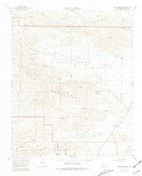
Hexie Mountains, California, USGS topographic map dated 1963.
Includes geographic coordinates (latitude and longitude). This topographic map is suitable for hiking, camping, and exploring, or framing it as a wall map.
Printed on-demand using high resolution imagery, on heavy weight and acid free paper, or alternatively on a variety of synthetic materials.
Topos available on paper, Waterproof, Poly, or Tyvek. Usually shipping rolled, unless combined with other folded maps in one order.
- Product Number: USGS-5502177
- Free digital map download (high-resolution, GeoPDF): Hexie Mountains, California (file size: 6 MB)
- Map Size: please refer to the dimensions of the GeoPDF map above
- Weight (paper map): ca. 55 grams
- Map Type: POD USGS Topographic Map
- Map Series: HTMC
- Map Verison: Historical
- Cell ID: 55304
- Scan ID: 297712
- Imprint Year: 1981
- Aerial Photo Year: 1956
- Field Check Year: 1963
- Datum: NAD27
- Map Projection: Polyconic
- Map published by United States Geological Survey
- Map Language: English
- Scanner Resolution: 600 dpi
- Map Cell Name: Hexie Mountains
- Grid size: 15 X 15 Minute
- Date on map: 1963
- Map Scale: 1:62500
- Geographical region: California, United States
Neighboring Maps:
All neighboring USGS topo maps are available for sale online at a variety of scales.
Spatial coverage:
Topo map Hexie Mountains, California, covers the geographical area associated the following places:
- Old Swede Mine - Silver Bell Mine - Cholla Garden - Cholla Garden Nature Trail - Joshua Tree National Park - Washington Wash - Hexie Mountains - Golden Bee Mine - Smoke Tree Well - Pinkham Spring - Porcupine Wash - Monument Mountain - Eldorado Mine - Snow Cloud Mine - Ruby Lee Well - Paymaster Mine - Golden Bell Mine - Pleasant Valley - Pinkham Well - Wilson Canyon - Star Mine - Pinto Mountain - Dalton Mine - Fried Liver Wash - Turkey Flat
- Map Area ID: AREA3433.75-116-115.75
- Northwest corner Lat/Long code: USGSNW34-116
- Northeast corner Lat/Long code: USGSNE34-115.75
- Southwest corner Lat/Long code: USGSSW33.75-116
- Southeast corner Lat/Long code: USGSSE33.75-115.75
- Northern map edge Latitude: 34
- Southern map edge Latitude: 33.75
- Western map edge Longitude: -116
- Eastern map edge Longitude: -115.75


