
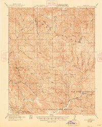
~ Gilroy Hot Springs CA topo map, 1:62500 scale, 15 X 15 Minute, Historical, 1921, updated 1948
Gilroy Hot Springs, California, USGS topographic map dated 1921.
Includes geographic coordinates (latitude and longitude). This topographic map is suitable for hiking, camping, and exploring, or framing it as a wall map.
Printed on-demand using high resolution imagery, on heavy weight and acid free paper, or alternatively on a variety of synthetic materials.
Topos available on paper, Waterproof, Poly, or Tyvek. Usually shipping rolled, unless combined with other folded maps in one order.
- Product Number: USGS-5501913
- Free digital map download (high-resolution, GeoPDF): Gilroy Hot Springs, California (file size: 11 MB)
- Map Size: please refer to the dimensions of the GeoPDF map above
- Weight (paper map): ca. 55 grams
- Map Type: POD USGS Topographic Map
- Map Series: HTMC
- Map Verison: Historical
- Cell ID: 54590
- Scan ID: 297560
- Imprint Year: 1948
- Survey Year: 1918
- Datum: NAD
- Map Projection: Polyconic
- Map published by United States Geological Survey
- Map published by United States Army Corps of Engineers
- Map published by United States Department of War
- Map Language: English
- Scanner Resolution: 600 dpi
- Map Cell Name: Gilroy Hot Springs
- Grid size: 15 X 15 Minute
- Date on map: 1921
- Map Scale: 1:62500
- Geographical region: California, United States
Neighboring Maps:
All neighboring USGS topo maps are available for sale online at a variety of scales.
Spatial coverage:
Topo map Gilroy Hot Springs, California, covers the geographical area associated the following places:
- Hoover Lake - North Fork Dam - Gulnac Peak - Cedar Creek - Hunting Hollow - Gilroy Hot Springs - Murry 1620-003 Dam - Kickham Peak - Rough Gulch - Rock House Ridge - Pine Springs Hill - Rock Springs Peak - Mississippi Creek - Gill Ranch - Pacheco Lake - East Fork Coyote Creek - Shaeirn Ranch - Paradise Flat - Bills Hill - Bear Creek - Palassou Ridge - Hurricane Canyon - Willow Ridge - Pacheco Peak - Cañada De La Dormida - Coit Dam - Board Springs - Braen Canyon - Bear Mountain - Black Hill - Bulhead Reservoir - East Fork Pacheco Creek - Harper Canyon - Hamner Hill - Coon Hunters Gulch - Chimney Canyon - Department of Forestry and Fire Protection Station 31 Pacheco - Soda Springs Canyon - Bear Springs - Dowdy Ranch - Willson Peak - Pigeon Point - Big Canyon - Shaeirn Lake - Vasquez Peak - Center Flats - Mustang Flat - Department of Forestry and Fire Protection Station 21 Coyote - Water Gulch - North Fork Pacheco Creek - Pine Spring Canyon - Cañada De Los Osos - Mustang Canyon - Elephant Head - Cow Canyon - Coit Lake - The Narrows - Middle Fork Coyote Creek - Phegley Ridge - Dexter Canyon - Buckeye Canyon - Lovers Leap - Chimney Gulch - Turkey Flat - Hog Canyon - Rooster Comb - Willson Ranch - Mustang Ridge - Elephant Head Creek - Bell Station - Bullhead Canyon - Hartman Creek - Pacheco Ranger Station - South Fork Pacheco Creek - Lake Mountain - Oak Springs Reservoir - Mustang Peak - Elephant Head Ridge - Coon Creek - Little Rough Gulch - Hagerman Canyon - Kaufman Ridge - Kelly Cabin Canyon - Burra Burra Peak - Red Creek - Chimney Rock - O'Connor Ranch - Kelly Cabin Canyon 1620-002 Dam
- Map Area ID: AREA37.2537-121.5-121.25
- Northwest corner Lat/Long code: USGSNW37.25-121.5
- Northeast corner Lat/Long code: USGSNE37.25-121.25
- Southwest corner Lat/Long code: USGSSW37-121.5
- Southeast corner Lat/Long code: USGSSE37-121.25
- Northern map edge Latitude: 37.25
- Southern map edge Latitude: 37
- Western map edge Longitude: -121.5
- Eastern map edge Longitude: -121.25


