
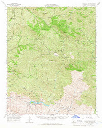
~ Gibraltar Dam CA topo map, 1:62500 scale, 15 X 15 Minute, Historical, 1964, updated 1966
Gibraltar Dam, California, USGS topographic map dated 1964.
Includes geographic coordinates (latitude and longitude). This topographic map is suitable for hiking, camping, and exploring, or framing it as a wall map.
Printed on-demand using high resolution imagery, on heavy weight and acid free paper, or alternatively on a variety of synthetic materials.
Topos available on paper, Waterproof, Poly, or Tyvek. Usually shipping rolled, unless combined with other folded maps in one order.
- Product Number: USGS-5501901
- Free digital map download (high-resolution, GeoPDF): Gibraltar Dam, California (file size: 12 MB)
- Map Size: please refer to the dimensions of the GeoPDF map above
- Weight (paper map): ca. 55 grams
- Map Type: POD USGS Topographic Map
- Map Series: HTMC
- Map Verison: Historical
- Cell ID: 54560
- Scan ID: 297554
- Imprint Year: 1966
- Woodland Tint: Yes
- Datum: NAD27
- Map Projection: Polyconic
- Map published by United States Geological Survey
- Map Language: English
- Scanner Resolution: 600 dpi
- Map Cell Name: Gibraltar Dam
- Grid size: 15 X 15 Minute
- Date on map: 1964
- Map Scale: 1:62500
- Geographical region: California, United States
Neighboring Maps:
All neighboring USGS topo maps are available for sale online at a variety of scales.
Spatial coverage:
Topo map Gibraltar Dam, California, covers the geographical area associated the following places:
- P-Bar Flats - Indian Creek Campground - Diablo Canyon - Pens Campground - Chokecherry Canyon - Dick Smith Wilderness - Lower Bear Campground - Lower Camuesa Campground - Lacosca Creek - Don Victor Canyon - Pie Canyon - Indian Creek - Pegleg Campground - Little Pine Mountain - Pine Canyon - Hidden Potvero Rustic Campsite - Upper Camuesa Campground - Pelch Camp - Big Cliente Debris Dam - Matias Potrero - Judell Canyon - Pendola Campground - Choke Cherry Spring - Coche Campground - The Caracole - Devils Canyon - Hollow Tree Campground - Fall Canyon - Grapevine Creek - Big Caliente Debris Dam - P-Bar Flats Campground - Pie Canyon Trail - Happy Hollow Guard Station - Chokecherry Spring - Bill Farris Campground - Gibraltar Reservoir - Agua Caliente Trail - Madulce Guard Station - Blue Canyon - Heath Campground - Camuesa Peak - Agua Caliente Spring - Buck Campground - Rattlesnake Canyon - Middle Buckhorn Campground - Madulce Peak - Gibraltar Mine - Bear Creek - Buckhorn Creek - Fall Recreation Site - Mono Debris Dam - Loma Pelona - Lower Buckhorn Campground - Los Prietos Y Najalayegua - Mono Creek - Alamar Guard Station - Poplar Campground - Don Victor Valley - Mission Pine Trail - Alamar Canyon - Horse Canyon - Middle Camuesa Campground - Santa Ynez Campground - Gidney Creek - Camuesa Creek - Samon Peak - Big Caliente Recreation Site - Upper Mono Trail - Little Caliente Spring - North Portal - Indian Creek Campground - Dinsomore Campground - Camuesa Canyon - Red Rock Campground - Madulce Rustic Campsite - Don Victor Campground - Alamar Hill Trail - East Fork Diablo Canyon - Bluff Campground - Roblar Canyon - Rose Canyon - Forbush Flat Rustic Campsite - Big Pine Canyon - Lower Grapevine Campground - Big Pine Campground - Buckhorn Trail - Pie Canyon Trail - Hidden Potrero - Sisquoc Falls - Hildreth Peak - Pine Canyon Campground - Agua Caliente Canyon - The Narrows - Mansfield Campground - Madulce Trail - Red Rock Campground - Mission Pine Basin - Lower Caliente Recreation Site - Logan Canyon - The Pines Campground
- Map Area ID: AREA34.7534.5-119.75-119.5
- Northwest corner Lat/Long code: USGSNW34.75-119.75
- Northeast corner Lat/Long code: USGSNE34.75-119.5
- Southwest corner Lat/Long code: USGSSW34.5-119.75
- Southeast corner Lat/Long code: USGSSE34.5-119.5
- Northern map edge Latitude: 34.75
- Southern map edge Latitude: 34.5
- Western map edge Longitude: -119.75
- Eastern map edge Longitude: -119.5


