
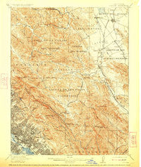
~ Concord CA topo map, 1:62500 scale, 15 X 15 Minute, Historical, 1915, updated 1923
Concord, California, USGS topographic map dated 1915.
Includes geographic coordinates (latitude and longitude). This topographic map is suitable for hiking, camping, and exploring, or framing it as a wall map.
Printed on-demand using high resolution imagery, on heavy weight and acid free paper, or alternatively on a variety of synthetic materials.
Topos available on paper, Waterproof, Poly, or Tyvek. Usually shipping rolled, unless combined with other folded maps in one order.
- Product Number: USGS-5501191
- Free digital map download (high-resolution, GeoPDF): Concord, California (file size: 12 MB)
- Map Size: please refer to the dimensions of the GeoPDF map above
- Weight (paper map): ca. 55 grams
- Map Type: POD USGS Topographic Map
- Map Series: HTMC
- Map Verison: Historical
- Cell ID: 52864
- Scan ID: 297164
- Imprint Year: 1923
- Survey Year: 1894
- Datum: Unstated
- Map Projection: Unstated
- Map published by United States Geological Survey
- Map Language: English
- Scanner Resolution: 600 dpi
- Map Cell Name: Concord
- Grid size: 15 X 15 Minute
- Date on map: 1915
- Map Scale: 1:62500
- Geographical region: California, United States
Neighboring Maps:
All neighboring USGS topo maps are available for sale online at a variety of scales.
Spatial coverage:
Topo map Concord, California, covers the geographical area associated the following places:
- Orinda Village - Walnut Creek - Sunny Acres Trailer Park - Muir - Waldon - Laurel - Eastmont - Dimond District - Alamo - Bancroft - Allendale - Claremont - Elmhurst - Rockridge - Moraga - Four Corners - Fernside - Saranap - Highland Park - Walnut Heights - Brookshire - Lockwood Gardens - Orinda - Glorietta - Millsmont - Glen Frazer - Concord - Maxwell Park - Valle Vista - Melrose - Piedmont - Montclair - Pacheco - Rheem - Canyon - Meinert - Alameda - Leona Heights - Trestle Glen - Fruitvale - Hookston - Redwood Heights - Contra Costa Centre - Las Juntas - Crocker Highlands - Grand Lake - Lafayette - Pleasant Hill - Havenscourt - Sparkle - Seminary Park - Eastport
- Map Area ID: AREA3837.75-122.25-122
- Northwest corner Lat/Long code: USGSNW38-122.25
- Northeast corner Lat/Long code: USGSNE38-122
- Southwest corner Lat/Long code: USGSSW37.75-122.25
- Southeast corner Lat/Long code: USGSSE37.75-122
- Northern map edge Latitude: 38
- Southern map edge Latitude: 37.75
- Western map edge Longitude: -122.25
- Eastern map edge Longitude: -122


