
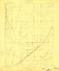
~ Landlow CA topo map, 1:31680 scale, 7.5 X 7.5 Minute, Historical, 1911
Landlow, California, USGS topographic map dated 1911.
Includes geographic coordinates (latitude and longitude). This topographic map is suitable for hiking, camping, and exploring, or framing it as a wall map.
Printed on-demand using high resolution imagery, on heavy weight and acid free paper, or alternatively on a variety of synthetic materials.
Topos available on paper, Waterproof, Poly, or Tyvek. Usually shipping rolled, unless combined with other folded maps in one order.
- Product Number: USGS-5499551
- Free digital map download (high-resolution, GeoPDF): Landlow, California (file size: 4 MB)
- Map Size: please refer to the dimensions of the GeoPDF map above
- Weight (paper map): ca. 55 grams
- Map Type: POD USGS Topographic Map
- Map Series: HTMC
- Map Verison: Historical
- Cell ID: 48238
- Scan ID: 296227
- Survey Year: 1910
- Datum: Unstated
- Map Projection: Unstated
- Map published by United States Geological Survey
- Map Language: English
- Scanner Resolution: 600 dpi
- Map Cell Name: West of Biggs
- Grid size: 7.5 X 7.5 Minute
- Date on map: 1911
- Map Scale: 1:31680
- Geographical region: California, United States
Neighboring Maps:
All neighboring USGS topo maps are available for sale online at a variety of scales.
Spatial coverage:
Topo map Landlow, California, covers the geographical area associated the following places:
- Ashley Lateral - Bradford Lateral - Biggs Division - High Gravity Lateral - Richvale Census Designated Place - Watt Lateral - Main Drainage Canal - Schwind Lateral - McKee Lateral - Browning Lateral - Richvale Airport - Schohr Ranch - Baker Lateral - Landlow School (historical) - Green Lateral - Low Gravity Wickman Lateral - D D 100 Main Drain - Gravity Lateral
- Map Area ID: AREA39.539.375-121.875-121.75
- Northwest corner Lat/Long code: USGSNW39.5-121.875
- Northeast corner Lat/Long code: USGSNE39.5-121.75
- Southwest corner Lat/Long code: USGSSW39.375-121.875
- Southeast corner Lat/Long code: USGSSE39.375-121.75
- Northern map edge Latitude: 39.5
- Southern map edge Latitude: 39.375
- Western map edge Longitude: -121.875
- Eastern map edge Longitude: -121.75


