
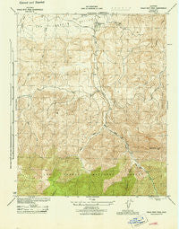
~ Eagle Rest Peak CA topo map, 1:31680 scale, 7.5 X 7.5 Minute, Historical, 1944, updated 1944
Eagle Rest Peak, California, USGS topographic map dated 1944.
Includes geographic coordinates (latitude and longitude). This topographic map is suitable for hiking, camping, and exploring, or framing it as a wall map.
Printed on-demand using high resolution imagery, on heavy weight and acid free paper, or alternatively on a variety of synthetic materials.
Topos available on paper, Waterproof, Poly, or Tyvek. Usually shipping rolled, unless combined with other folded maps in one order.
- Product Number: USGS-5499263
- Free digital map download (high-resolution, GeoPDF): Eagle Rest Peak, California (file size: 9 MB)
- Map Size: please refer to the dimensions of the GeoPDF map above
- Weight (paper map): ca. 55 grams
- Map Type: POD USGS Topographic Map
- Map Series: HTMC
- Map Verison: Historical
- Cell ID: 13274
- Scan ID: 296065
- Imprint Year: 1944
- Woodland Tint: Yes
- Datum: NAD27
- Map Projection: Polyconic
- Map published by United States Army Corps of Engineers
- Map published by United States Department of War
- Map Language: English
- Scanner Resolution: 600 dpi
- Map Cell Name: Eagle Rest Peak
- Grid size: 7.5 X 7.5 Minute
- Date on map: 1944
- Map Scale: 1:31680
- Geographical region: California, United States
Neighboring Maps:
All neighboring USGS topo maps are available for sale online at a variety of scales.
Spatial coverage:
Topo map Eagle Rest Peak, California, covers the geographical area associated the following places:
- Marian Campground - Blue Ridge - Eagle Rest Peak - Devils Kitchen - San Emidio - San Emigdio Canyon - San Emidio Ranch - Brush Mountain - Cloudburst Canyon - Doc Williams Canyon
- Map Area ID: AREA3534.875-119.25-119.125
- Northwest corner Lat/Long code: USGSNW35-119.25
- Northeast corner Lat/Long code: USGSNE35-119.125
- Southwest corner Lat/Long code: USGSSW34.875-119.25
- Southeast corner Lat/Long code: USGSSE34.875-119.125
- Northern map edge Latitude: 35
- Southern map edge Latitude: 34.875
- Western map edge Longitude: -119.25
- Eastern map edge Longitude: -119.125


