
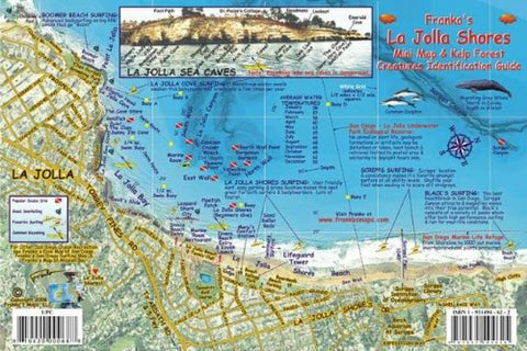
California Fish Card, La Jolla Shores 2008 by Frankos Maps Ltd.
Side 1 is a detailed map of the shoreline from Seal Rock to Blacks Beach. Contour lines and labels (in feet) show depths. Locates favorite diving and surfing spots and places to kayak. Photograph shows La Jolla Sea Caves, each labeled by name, as seen from between the swim buoys. Nearby roads labeled directly on the map. Side 2 provides color illustrations and common names of animals found in the kelp forest off San Diego, California. This convenient, waterproof reference is made of hard, laminated plastic with hole for lanyard. 6 x 9
- Product Number: 2043053M
- Product Code: FM_LJ_FISH
- ISBN: 9781931494625
- Year of Publication: 2008
- Unfolded Size: 5.91 x 8.86 inches
- Map type: Flat Map
- Geographical region: California


