
California Map, Channel Islands Guide and Dive, folded, 2011 by Frankos Maps Ltd.
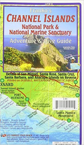
Side 1 of Frankos Map of the Channel Islands shows the Santa Barbara-Ventura Coast of California with the five islands (San Miguel Island, Santa Rosa Island, Santa Cruz Island, Anacapa Island, and Santa Barbara Island) in fabulous green shaded relief to show their hills and valleys, as they sit in an ocean of descending blue contours. Shaded-relief accuracy is via USGS data, and ocean depth contours are from NOAA data. Map includes A brief summary description of each island, beautiful underwater wildlife photos, drawings of dozens of local undersea critters and dive sites.
Side 2 shows each of the five Channel Islands in the National Park and National Marine Sanctuary individually. Numerous anchorages are shown, as are favorite scuba diving spots.
- Product Number: 2034454M
- Product Code: FM_CHANNEL_IS
- ISBN: 9781601901651
- Year of Publication: 2011
- Folded Size: 7.09 x 4.33 inches
- Unfolded Size: 13.39 x 20.47 inches
- Map type: Folded Map
- Geographical region: California


