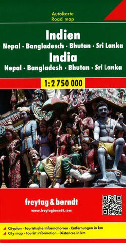
India, Nepal, Bangladesh, Bhutan and Sri Lanka by Freytag-Berndt und Artaria
Explore the Indian sub-continent with this Freytag & Berndt road map. The best way to plan your trip, prepare your itinerary, and to travel independently in India, Nepal, Bhutan, Sri Lanka, Bangladesh and Eastern Pakistan. As with all Freytag & Berndt maps the cartography is clear and detailed with the topography shown by relief shading with plenty of spot heights.
The map also includes insets of the northeastern Indian state of Arunachal Pradesh, the islands of Andaman and Nicobar, and the center of Delhi city.
Tourist information and places of interest are clearly marked by a range of icons, including:
road classifications
rail lines
ferry routes
physical features
temples and churches
Distances between points are shown as well as indications of steep gradients, all distances are in kilometres. The legend is in English, German, French, Italian, and some local languages.
- Product Number: 2030312M
- Product Code: FB_INDIA
- ISBN: 9783707902655
- Year of Publication: 2010
- Folded Size: 10.24 x 5.12 inches
- Unfolded Size: 52.76 x 37.8 inches
- Map type: Folded Map
- Geographical region: Bhutan

