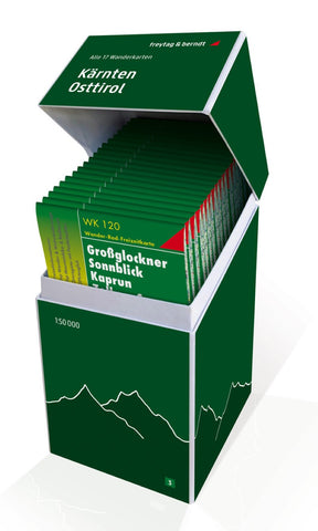
Carinthia - East Tyrol, hiking map set 1:50,000
This unique hiking map bundle contains a set with all 20 hiking maps for Carinthia and East Tyrol on a scale of 1: 50,000!
It is ideal for frequent hikers who want to explore nature on their tours! Freytag & Berndt hiking maps are ideal companions in hiking, mountaineering, cycling and ski tours thanks to the detailed digital cartography and the exact standards. They are also suitable for GPS. Contents: WK 120 Großglockner WK 123 Matrei WK 141 Julian Alps WK 181 Kals WK 202 Lienzer Dolomites WK 202 Radstädter Tauern WK 211 Nature Park Zirbitzkogel WK 222 Bad Kleinkirchheim WK 223 Karnische Alpen WK 225 Mölltal WK 231 Central Charmen WK 233 Wörthersee WK 237 Saubalpe WK 238 South Carinthia WK 411 Styrian wine country
- Product Number: FB_WK_BOX_3_20
- Reference Product Number: - None -
- ISBN: 9783707919035
- Date of Publication: 9/1/2020
- Folded Size: 8.45 inches high by 4.72 inches wide
- Unfolded (flat) Size: 8.45 inches high by 4.72 inches wide
- Map format: Folded
- Map type: Trade Maps - Hiking
- Geographical region: Austria