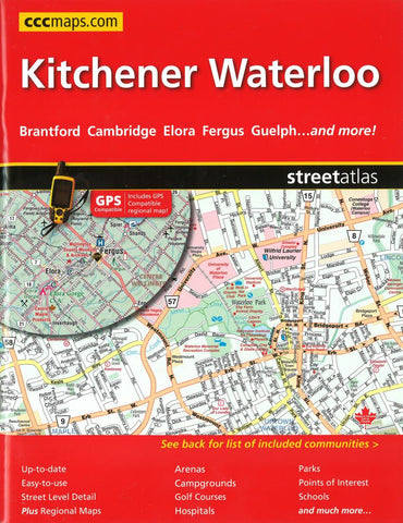
Kitchener and Waterloo, ON Street Atlas by Canadian Cartographics Corporation
Street Atlas This CCC Eastern Ontario Street Atlas is up-to-date and easy-to-use. Its the definitive auto companion for travel in this area, whether you are a resident or short-term visitor. Its got all the features to make even the unfamiliar areas easy to navigate. Now includes all new 1:200,000 scale area map that is GPS compatible. Includes city maps of: Aberfoyle, Arthur, Ayr, Baden, Brantford, Breslau, Cambridge, Conestogo, Delhi, Elmira, Elora, Erin, Fergus, Guelph, Heidelberg, Kitchener, Mannheim, Morriston, New Dundee, New Hamburg, Paris, Port Dover, Rockwood, St. Clements, St. Jacobs, Simcoe, Waterford and Waterloo. Features: Regional maps, Arenas, Golf Courses, Parks, Points of Interest, Hospitals, Schools, Skiing and much more.
- Product Number: 2213998
- Product Code: CCC_KITCHEN_AT
- ISBN: 9781551982861
- Year of Publication: 2015
- Unfolded Size: 11.02 x 8.66 inches
- Map type: Atlas
- Geographical region: Ontario