
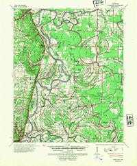
~ Whitmore AR topo map, 1:62500 scale, 15 X 15 Minute, Historical, 1940, updated 1954
Whitmore, Arkansas, USGS topographic map dated 1940.
Includes geographic coordinates (latitude and longitude). This topographic map is suitable for hiking, camping, and exploring, or framing it as a wall map.
Printed on-demand using high resolution imagery, on heavy weight and acid free paper, or alternatively on a variety of synthetic materials.
Topos available on paper, Waterproof, Poly, or Tyvek. Usually shipping rolled, unless combined with other folded maps in one order.
- Product Number: USGS-5429732
- Free digital map download (high-resolution, GeoPDF): Whitmore, Arkansas (file size: 9 MB)
- Map Size: please refer to the dimensions of the GeoPDF map above
- Weight (paper map): ca. 55 grams
- Map Type: POD USGS Topographic Map
- Map Series: HTMC
- Map Verison: Historical
- Cell ID: 64509
- Scan ID: 260371
- Imprint Year: 1954
- Woodland Tint: Yes
- Edit Year: 1940
- Datum: NAD
- Map Projection: Polyconic
- Map published by United States Army Corps of Engineers
- Map published by United States Department of War
- Map Language: English
- Scanner Resolution: 600 dpi
- Map Cell Name: Whitmore
- Grid size: 15 X 15 Minute
- Date on map: 1940
- Map Scale: 1:62500
- Geographical region: Arkansas, United States
Neighboring Maps:
All neighboring USGS topo maps are available for sale online at a variety of scales.
Spatial coverage:
Topo map Whitmore, Arkansas, covers the geographical area associated the following places:
- Cicalla - Duvall - Kinton - Clarks Corner - Gieseck - Rose Place - Patterson (historical) - Riverside - Burnt Cane - Cottonwood Corner - Budsmith (historical) - Crow Creek - Newcastle - Widener - Lucerne - Levesque - Wittsburg - Round Pond - Blackfish - Bailes (historical) - New Home - Whitmore - Flag Lake Crossing - Midway - Hicks Station - Gladden - Madison
- Map Area ID: AREA35.2535-90.75-90.5
- Northwest corner Lat/Long code: USGSNW35.25-90.75
- Northeast corner Lat/Long code: USGSNE35.25-90.5
- Southwest corner Lat/Long code: USGSSW35-90.75
- Southeast corner Lat/Long code: USGSSE35-90.5
- Northern map edge Latitude: 35.25
- Southern map edge Latitude: 35
- Western map edge Longitude: -90.75
- Eastern map edge Longitude: -90.5


