
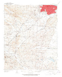
~ Alexander AR topo map, 1:62500 scale, 15 X 15 Minute, Historical, 1935, updated 1965
Alexander, Arkansas, USGS topographic map dated 1935.
Includes geographic coordinates (latitude and longitude). This topographic map is suitable for hiking, camping, and exploring, or framing it as a wall map.
Printed on-demand using high resolution imagery, on heavy weight and acid free paper, or alternatively on a variety of synthetic materials.
Topos available on paper, Waterproof, Poly, or Tyvek. Usually shipping rolled, unless combined with other folded maps in one order.
- Product Number: USGS-5429078
- Free digital map download (high-resolution, GeoPDF): Alexander, Arkansas (file size: 8 MB)
- Map Size: please refer to the dimensions of the GeoPDF map above
- Weight (paper map): ca. 55 grams
- Map Type: POD USGS Topographic Map
- Map Series: HTMC
- Map Verison: Historical
- Cell ID: 50412
- Scan ID: 259968
- Imprint Year: 1965
- Survey Year: 1935
- Datum: NAD27
- Map Projection: Polyconic
- Map published by United States Geological Survey
- Map Language: English
- Scanner Resolution: 600 dpi
- Map Cell Name: Alexander
- Grid size: 15 X 15 Minute
- Date on map: 1935
- Map Scale: 1:62500
- Geographical region: Arkansas, United States
Neighboring Maps:
All neighboring USGS topo maps are available for sale online at a variety of scales.
Spatial coverage:
Topo map Alexander, Arkansas, covers the geographical area associated the following places:
- Altharp (historical) - Vimy Ridge - Evergreen - Timber Ridge - Dirtdauber (historical) - Terrytown - Berger - Pecan Lake - Ponderosa - Mabelvale - Applegate - Deer Meadow - Westwood - Brownwood Terrace - Cloverdale - Rosedale - Spring Valley - Iron Springs - Little Rock - Tall Timbers West - Brooks - Wakefield Village - Westbrook - Shiloh - Lakeside - Yorkwood - Gum Springs - Woodland Ridge - Twin Oaks - Rusty Pines - Base Line - East End - Landmark - Raintree Acres - Skylark - Douglasville - Allendale Manor - Goodman - Careywood - Fairview - Red Gate - Woodland Hills - Biddle - Guilford (historical) - Alexander - Lignite - Pine Haven - Town and Country Estates - McClellan Place - Twin Springs - Brittain - Banty (historical) - Arbor Cove - Hot Springs Junction - Geyer Springs - Gillam Park - Bingham - Windamere - Meadowcliff - Beverly Terrace - Merrivale - American Manor - Ward - Bryant Oaks - Sardis - Parkers - Brooks (historical) - Ironton - Bryant - Kensington Place - Alpine - Collegeville - Otter Creek - Woodyardville - Martindale - Hurricane (historical) - Oak Forest - Azalea Place - Shannon Hills - Douglas Corner
- Map Area ID: AREA34.7534.5-92.5-92.25
- Northwest corner Lat/Long code: USGSNW34.75-92.5
- Northeast corner Lat/Long code: USGSNE34.75-92.25
- Southwest corner Lat/Long code: USGSSW34.5-92.5
- Southeast corner Lat/Long code: USGSSE34.5-92.25
- Northern map edge Latitude: 34.75
- Southern map edge Latitude: 34.5
- Western map edge Longitude: -92.5
- Eastern map edge Longitude: -92.25


