
~ Brooklyn Peak AZ topo map, 1:24000 scale, 7.5 X 7.5 Minute, 2014
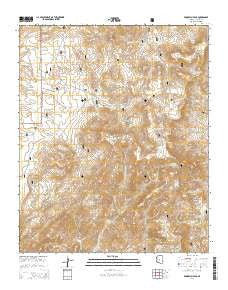
Brooklyn Peak, Arizona, USGS topographic map dated 2014.
Includes geographic coordinates (latitude and longitude). This topographic map is suitable for hiking, camping, and exploring, or framing it as a wall map.
Printed on-demand using high resolution imagery, on heavy weight and acid free paper, or alternatively on a variety of synthetic materials.
Topos available on paper, Waterproof, Poly, or Tyvek. Usually shipping rolled, unless combined with other folded maps in one order.
- Product Number: USGS-7242139
- Free digital map download (high-resolution, GeoPDF): Brooklyn Peak, Arizona (file size: 27 MB)
- Map Size: please refer to the dimensions of the GeoPDF map above
- Weight (paper map): ca. 55 grams
- Map Type: POD USGS Topographic Map
- Map Series: US Topo
- Map Verison: Current
- Cell ID: 69459
- Datum: North American Datum of 1983
- Map Projection: Transverse Mercator
- Map Cell Name: Brooklyn Peak
- Grid size: 7.5 X 7.5 Minute
- Date on map: 2014
- Map Scale: 1:24000
- Geographical region: Arizona, United States
Neighboring Maps:
All neighboring USGS topo maps are available for sale online at a variety of scales.
Spatial coverage:
Topo map Brooklyn Peak, Arizona, covers the geographical area associated the following places:
- Little Hutch Spring - Cornstalk Flat Tank - Six Bar Ranch - Rosalie Spring - Mesa Butte - Six Bar Mesa Tank - Middle Fork Spring - Hutch Mesa - Piedmont Well - Wood Camp Cabin - Johns Tank - Brooklyn Tank - Brooklyn Well - Rincon Spring - Copper Spring - Bishop Spring - Copper Creek Tank - Rosalie Mine - Copper Tank - Hardscrabble Tank - Rosalie Tank - Spring Tank - Juniper Tank - Picnic Tank - Copper Creek Cabin - Wanda Seep - Hutch Tank - Narrows Tank - Hutch Springs - Copper Creek Administrative Site - Brooklyn Mine - Rugged Mesa - Hogan Tank Number One - Brooklyn Peak - Juniper Spring - Middle Fork Tank - Wright Cabin - East Branch Squaw Creek - Hogan Spring - North Campbell Tank - Rugged Well - Quinine Bush Tank - Hogan Tank Number Two - Crockett Cabin - Rockhouse Tank - Cornstalk Flat - Sycamore Spring - Double Corral Tank - Six Bar Ridge - United Arizona Mine (historical) - Shirttail Spring - Goat Peak - North Fork Tank - Hogan Cabin - South Campbell Tank - Walnut Spring - Hutch Tank
- Map Area ID: AREA34.2534.125-112-111.875
- Northwest corner Lat/Long code: USGSNW34.25-112
- Northeast corner Lat/Long code: USGSNE34.25-111.875
- Southwest corner Lat/Long code: USGSSW34.125-112
- Southeast corner Lat/Long code: USGSSE34.125-111.875
- Northern map edge Latitude: 34.25
- Southern map edge Latitude: 34.125
- Western map edge Longitude: -112
- Eastern map edge Longitude: -111.875


