
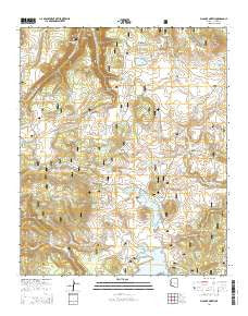
~ Big Lake North AZ topo map, 1:24000 scale, 7.5 X 7.5 Minute, 2014
Big Lake North, Arizona, USGS topographic map dated 2014.
Includes geographic coordinates (latitude and longitude). This topographic map is suitable for hiking, camping, and exploring, or framing it as a wall map.
Printed on-demand using high resolution imagery, on heavy weight and acid free paper, or alternatively on a variety of synthetic materials.
Topos available on paper, Waterproof, Poly, or Tyvek. Usually shipping rolled, unless combined with other folded maps in one order.
- Product Number: USGS-7235478
- Free digital map download (high-resolution, GeoPDF): Big Lake North, Arizona (file size: 24 MB)
- Map Size: please refer to the dimensions of the GeoPDF map above
- Weight (paper map): ca. 55 grams
- Map Type: POD USGS Topographic Map
- Map Series: US Topo
- Map Verison: Current
- Cell ID: 3760
- Datum: North American Datum of 1983
- Map Projection: Transverse Mercator
- Map Cell Name: Big Lake North
- Grid size: 7.5 X 7.5 Minute
- Date on map: 2014
- Map Scale: 1:24000
- Geographical region: Arizona, United States
Neighboring Maps:
All neighboring USGS topo maps are available for sale online at a variety of scales.
Spatial coverage:
Topo map Big Lake North, Arizona, covers the geographical area associated the following places:
- Burro Mountain Weir - Bill Riley Tank - North Fork Black River - Dipping Vat Reservoir - Big Lake Recreation Area - Crescent Lake - Pool Knoll Tank - Burro Creek Spring Number 1 - Marble Spring - Pool Corral Lake Tank - Track Tank - Wahl Knoll - Little Spring - Spruce Spring - Ant Tank - Blade Tank - Udall Pit Tank Number 8 - Turkey Draw Spring - Boundary Tank - Voigt Spring - Hog Wallow Lake - 72 Tank - Lee Valley Dam - Round Cienega Spring - Spence Cabin - Horse Corral Spring - Crescent Lake Dam - Head of Black River Springs - 75 Spring - Tommie Spring - Rudd Knoll Pit - Thompson Ranch - Big Lake Railroad Cove Boat Launch - Lower Tank - Half Tank - Point Spring - Day Spring - Burro Creek Spring - Basin Lake - Rock Spring - Trap Tank Spring - Cherokee Tank - Trap Pit - Voigt Pit Tank Number 2 - Trap Spring - Amberon Point - Elk Pit Tank - Big Lake Forest Camp - Crescent Lake Dam Boat Launch - South Crescent Lake Boat Launch - Upper Tank - Cienega Spring - Lake Tank - Crossbar Tank - Merlyn Spring - Big Lake Marina - Seventy-Three Tank - East Fork Baldy Trail Ninetyfive - Seven Springs - Road Tank - Convicted Spring - Mel Tank - Butch Tank - Phelps Spring - Round Tank - Egg Tank - Voigt Ranch - Sugar Spring - Gabaldon Campground - River Number One Dam - Udall 12 Spring - Stock Tank Number 1 - Big Lake Dam - Slide Hill - Ruth Tank - Hog Wallow Dam - Burro Creek Spring - Fence Tank - Big Lake Boat Launch - Voigt Pit Tank Number 1 - Spruce Spring - Alleged Spring - SU Spring - Lee Valley Reservoir Boat Launch - Mud Tank - Pool Corral Dam - Crescent Lake West Side Boat Launch - Voigt Pit Tank Number Six - Thompson Creek - Crescent Lake Spring - Burro Mountain - BC Tank - Section 25 Tank - Seven Springs Well - Pool Corral Lake - South Fork Tank - Rudd Knoll Tank Number 5 - Fir Pit Tank - Wing Marsh - Deep Pit Tank
- Map Area ID: AREA3433.875-109.5-109.375
- Northwest corner Lat/Long code: USGSNW34-109.5
- Northeast corner Lat/Long code: USGSNE34-109.375
- Southwest corner Lat/Long code: USGSSW33.875-109.5
- Southeast corner Lat/Long code: USGSSE33.875-109.375
- Northern map edge Latitude: 34
- Southern map edge Latitude: 33.875
- Western map edge Longitude: -109.5
- Eastern map edge Longitude: -109.375


