
~ Verde AZ topo map, 1:250000 scale, 1 X 1 Degree, Historical, 1892
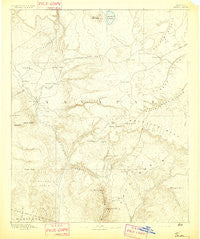
Verde, Arizona, USGS topographic map dated 1892.
Includes geographic coordinates (latitude and longitude). This topographic map is suitable for hiking, camping, and exploring, or framing it as a wall map.
Printed on-demand using high resolution imagery, on heavy weight and acid free paper, or alternatively on a variety of synthetic materials.
Topos available on paper, Waterproof, Poly, or Tyvek. Usually shipping rolled, unless combined with other folded maps in one order.
- Product Number: USGS-5618364
- Free digital map download (high-resolution, GeoPDF): Verde, Arizona (file size: 6 MB)
- Map Size: please refer to the dimensions of the GeoPDF map above
- Weight (paper map): ca. 55 grams
- Map Type: POD USGS Topographic Map
- Map Series: HTMC
- Map Verison: Historical
- Cell ID: 322205
- Scan ID: 315619
- Survey Year: 1885
- Datum: Unstated
- Map Projection: Unstated
- Map published by United States Geological Survey
- Map Language: English
- Scanner Resolution: 600 dpi
- Map Cell Name: Holbrook W
- Grid size: 1 X 1 Degree
- Date on map: 1892
- Map Scale: 1:250000
- Geographical region: Arizona, United States
Neighboring Maps:
All neighboring USGS topo maps are available for sale online at a variety of scales.
Spatial coverage:
Topo map Verde, Arizona, covers the geographical area associated the following places:
- Fort McDonald - Verde - Wingfield - Jordan Meadows - Washington Park - Thompson Draw Summer Homes Unit Two - Spurlock - Twin Lakes Mobile Home Park - Lakeview - Arnold Place - Sunset Village Mobile Home Park - Mesa del Caballo - Turkey Crossing - Munds Park - Lake Montezuma - Mormon Lake - Cedar Mill - Cedar Grove Mobile Home Park - Payson - Buffalo Run Mobile Home Park - West Sedona - Rimrock - Diamond Point Shadows - The Willows at Camp Verde Mobile Home Park - Macks Crossing - Fort Verde Estates - Strawberry - Tempe Camp - Camp Verde Mobile Home Park - Gallups - McGuireville - Hunter Creek Ranch - La Cienega - Mountain Shadows Mobile Trailer Resort - Baldwins Crossing - Allan Lake Landing - Christopher Creek - Geronimo Estates - Saint Joseph Youth Camp - Little Spring - Bignotti - Sherwood Forest Mobile Home Park - Sedona - Camp Verde - Tres Rios - Freedom Acres - Rainbow Trailer Park - Ponderosa Glen Mobile Home Park - Dugas - Long Valley - Tonto Village - Jakes Corner - Clear Creek - Paradise Acres - Verde River Meadows One - Bear Flat - Reddells Ranch Acres - Clints Well - Big Park - Campo Bonito - Pilgrim Playground - Star Valley - White Hills Mobile Home Park - Deer Creek Village Subdivision - See Canyon Summer Homes - Victorine Crossing - Ellison Creek Estates - Kohls Ranch - Oxbow Estates - Pioneer Acres - Happy Jack - Jordan - Diamond Point Summer Homes - Rockledge - Whispering Pines - Fort River Caves - Middle Verde - Flowing Springs - Road Junction Windmill - Cornville - Star Vale Mobile Home Park - Lawrence Crossing - Pine - Security Acres - Smelter City - Starview Mobile Home Park - Wonder Valley - Aultman - Page Springs - Ellison Creek Summer Homes - Oxbow Estates Mobile Home Park - Lamplighter Mobile Park - Mountain View Estates - Coffeepot - Kinder Crossing - Jones Crossing - Bonita Creek Estates - Rye - Tonto Estate - Mesa Verde Estates
- Map Area ID: AREA3534-112-111
- Northwest corner Lat/Long code: USGSNW35-112
- Northeast corner Lat/Long code: USGSNE35-111
- Southwest corner Lat/Long code: USGSSW34-112
- Southeast corner Lat/Long code: USGSSE34-111
- Northern map edge Latitude: 35
- Southern map edge Latitude: 34
- Western map edge Longitude: -112
- Eastern map edge Longitude: -111


