
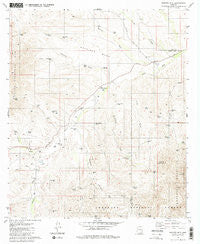
~ Saucito Mtn AZ topo map, 1:24000 scale, 7.5 X 7.5 Minute, Historical, 1981, updated 1981
Saucito Mtn , Arizona, USGS topographic map dated 1981.
Includes geographic coordinates (latitude and longitude). This topographic map is suitable for hiking, camping, and exploring, or framing it as a wall map.
Printed on-demand using high resolution imagery, on heavy weight and acid free paper, or alternatively on a variety of synthetic materials.
Topos available on paper, Waterproof, Poly, or Tyvek. Usually shipping rolled, unless combined with other folded maps in one order.
- Product Number: USGS-5555702
- Free digital map download (high-resolution, GeoPDF): Saucito Mtn , Arizona (file size: 12 MB)
- Map Size: please refer to the dimensions of the GeoPDF map above
- Weight (paper map): ca. 55 grams
- Map Type: POD USGS Topographic Map
- Map Series: HTMC
- Map Verison: Historical
- Cell ID: 40031
- Scan ID: 313285
- Imprint Year: 1981
- Woodland Tint: Yes
- Aerial Photo Year: 1975
- Edit Year: 1981
- Field Check Year: 1976
- Datum: NAD27
- Map Projection: Transverse Mercator
- Map published by United States Geological Survey
- Map Language: English
- Scanner Resolution: 600 dpi
- Map Cell Name: Saucito Mountain
- Grid size: 7.5 X 7.5 Minute
- Date on map: 1981
- Map Scale: 1:24000
- Geographical region: Arizona, United States
Neighboring Maps:
All neighboring USGS topo maps are available for sale online at a variety of scales.
Spatial coverage:
Topo map Saucito Mtn , Arizona, covers the geographical area associated the following places:
- Redondo Tank - Coyote Tank - Liebres Tank - Moyza Ranch - Canez Wash - Horseshoe Tank - Calera Draw - Suzy Q Tank - Horse Pasture Tank - New Well Windmill - Steer Pasture Tank - Peñasco Tank - Sheriffs Draw - Cuisanto Well - Saucito Wash - Rock Tank - Coyote Well - Anne Bee Well - Escondido Well - K X Ranch - Sparkplug Tank - Saucito Well - Sandy Tank - Sardina Canyon - Batamote Wash - Compressor Tank - Fresno Well - Line Tank - Mud Tank - Old Sopori School - Ellas Draw - Surprise Well - Bob Brown Well - Red Tank - Wino Tank - Boyd Tank - Red Spring - Santa Lucia Ranch - Papalote Wash - Moyza Canyon - Proctor Wash - Pete Tank - Saucito Mountain - Sardina Dam - Bob Brown Tank - Sheriffs Mesa - Papalote Alto - Tres Dedos Well - Colorado Wash - Media Well - Basin Tank - Argentina Well
- Map Area ID: AREA31.7531.625-111.25-111.125
- Northwest corner Lat/Long code: USGSNW31.75-111.25
- Northeast corner Lat/Long code: USGSNE31.75-111.125
- Southwest corner Lat/Long code: USGSSW31.625-111.25
- Southeast corner Lat/Long code: USGSSE31.625-111.125
- Northern map edge Latitude: 31.75
- Southern map edge Latitude: 31.625
- Western map edge Longitude: -111.25
- Eastern map edge Longitude: -111.125


