
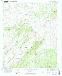
~ Cactus Flat AZ topo map, 1:24000 scale, 7.5 X 7.5 Minute, Historical, 1970, updated 1973
Cactus Flat, Arizona, USGS topographic map dated 1970.
Includes geographic coordinates (latitude and longitude). This topographic map is suitable for hiking, camping, and exploring, or framing it as a wall map.
Printed on-demand using high resolution imagery, on heavy weight and acid free paper, or alternatively on a variety of synthetic materials.
Topos available on paper, Waterproof, Poly, or Tyvek. Usually shipping rolled, unless combined with other folded maps in one order.
- Product Number: USGS-5550584
- Free digital map download (high-resolution, GeoPDF): Cactus Flat, Arizona (file size: 10 MB)
- Map Size: please refer to the dimensions of the GeoPDF map above
- Weight (paper map): ca. 55 grams
- Map Type: POD USGS Topographic Map
- Map Series: HTMC
- Map Verison: Historical
- Cell ID: 6611
- Scan ID: 310674
- Imprint Year: 1973
- Woodland Tint: Yes
- Visual Version Number: 1
- Aerial Photo Year: 1968
- Field Check Year: 1970
- Datum: NAD27
- Map Projection: Transverse Mercator
- Map published by United States Geological Survey
- Map Language: English
- Scanner Resolution: 600 dpi
- Map Cell Name: Cactus Flat
- Grid size: 7.5 X 7.5 Minute
- Date on map: 1970
- Map Scale: 1:24000
- Geographical region: Arizona, United States
Neighboring Maps:
All neighboring USGS topo maps are available for sale online at a variety of scales.
Spatial coverage:
Topo map Cactus Flat, Arizona, covers the geographical area associated the following places:
- Snowflake Division - Rattlesnake Draw - Town Draw - Ballard Tank - Cactus Flat Windmill - Mortensen Wash - Number Two Tank - Perkins Spring Draw - Wilson Draw - Thomas Windmill - Northeast Tank - Back Stop Tank - Spring Tank - Deborah Tank - Carlisle Tank - Bull Ranch Draw - Antelope Tank - East Well - Dodson Wash - Miller Tank - Cactus Flat - West Windmill - Linden Windmill - Drinker Tank - Rattlesnake Tank - Thomas Tank
- Map Area ID: AREA34.534.375-110.25-110.125
- Northwest corner Lat/Long code: USGSNW34.5-110.25
- Northeast corner Lat/Long code: USGSNE34.5-110.125
- Southwest corner Lat/Long code: USGSSW34.375-110.25
- Southeast corner Lat/Long code: USGSSE34.375-110.125
- Northern map edge Latitude: 34.5
- Southern map edge Latitude: 34.375
- Western map edge Longitude: -110.25
- Eastern map edge Longitude: -110.125


