
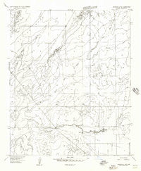
~ Adamana 4 NW AZ topo map, 1:24000 scale, 7.5 X 7.5 Minute, Historical, 1955, updated 1957
Adamana 4 NW, Arizona, USGS topographic map dated 1955.
Includes geographic coordinates (latitude and longitude). This topographic map is suitable for hiking, camping, and exploring, or framing it as a wall map.
Printed on-demand using high resolution imagery, on heavy weight and acid free paper, or alternatively on a variety of synthetic materials.
Topos available on paper, Waterproof, Poly, or Tyvek. Usually shipping rolled, unless combined with other folded maps in one order.
- Product Number: USGS-5549682
- Free digital map download (high-resolution, GeoPDF): Adamana 4 NW, Arizona (file size: 7 MB)
- Map Size: please refer to the dimensions of the GeoPDF map above
- Weight (paper map): ca. 55 grams
- Map Type: POD USGS Topographic Map
- Map Series: HTMC
- Map Verison: Historical
- Cell ID: 71290
- Scan ID: 310204
- Imprint Year: 1957
- Aerial Photo Year: 1953
- Datum: Unstated
- Map Projection: Unstated
- Preliminary map: Yes
- Map published by United States Geological Survey
- Keywords: Nonstandard Press Run
- Map Language: English
- Scanner Resolution: 600 dpi
- Map Cell Name: Potter Mesa Tank
- Grid size: 7.5 X 7.5 Minute
- Date on map: 1955
- Map Scale: 1:24000
- Geographical region: Arizona, United States
Neighboring Maps:
All neighboring USGS topo maps are available for sale online at a variety of scales.
Spatial coverage:
Topo map Adamana 4 NW, Arizona, covers the geographical area associated the following places:
- Potter Windmill - Zuñi River - Beaver Dam Wash - Beaver Dam Tank - Seven Springs Wash - S W Tank - Potter Mesa Tank - Small Salt Well Tank - Potter Mesa - Corner Salt Well Tank - Hutchinson Tank - Rim Tank - Upper Potter Mesa Tank - Hunt Valley - Beaver Dam Wash Well - Metias Tank - Salt Well Tank - South Tank - Salt Well - Beaver Dam Wash Bridge - Rock Crossing Windmill
- Map Area ID: AREA34.7534.625-109.75-109.625
- Northwest corner Lat/Long code: USGSNW34.75-109.75
- Northeast corner Lat/Long code: USGSNE34.75-109.625
- Southwest corner Lat/Long code: USGSSW34.625-109.75
- Southeast corner Lat/Long code: USGSSE34.625-109.625
- Northern map edge Latitude: 34.75
- Southern map edge Latitude: 34.625
- Western map edge Longitude: -109.75
- Eastern map edge Longitude: -109.625


