
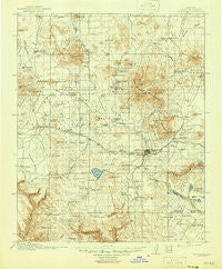
~ Flagstaff AZ topo map, 1:125000 scale, 30 X 30 Minute, Historical, 1912, updated 1946
Flagstaff, Arizona, USGS topographic map dated 1912.
Includes geographic coordinates (latitude and longitude). This topographic map is suitable for hiking, camping, and exploring, or framing it as a wall map.
Printed on-demand using high resolution imagery, on heavy weight and acid free paper, or alternatively on a variety of synthetic materials.
Topos available on paper, Waterproof, Poly, or Tyvek. Usually shipping rolled, unless combined with other folded maps in one order.
- Product Number: USGS-5549348
- Free digital map download (high-resolution, GeoPDF): Flagstaff, Arizona (file size: 8 MB)
- Map Size: please refer to the dimensions of the GeoPDF map above
- Weight (paper map): ca. 55 grams
- Map Type: POD USGS Topographic Map
- Map Series: HTMC
- Map Verison: Historical
- Cell ID: 65479
- Scan ID: 315357
- Imprint Year: 1946
- Survey Year: 1908
- Datum: Unstated
- Map Projection: Polyconic
- Map published by United States Geological Survey
- Map Language: English
- Scanner Resolution: 600 dpi
- Map Cell Name: Flagstaff
- Grid size: 30 X 30 Minute
- Date on map: 1912
- Map Scale: 1:125000
- Geographical region: Arizona, United States
Neighboring Maps:
All neighboring USGS topo maps are available for sale online at a variety of scales.
Spatial coverage:
Topo map Flagstaff, Arizona, covers the geographical area associated the following places:
- Wheel Inn Mobile Home Park - Maine - Hidden Hollow Mobile Home Park - Canyon View Mobile Home Park - Cameo Mobile Home Park - Riordan - Bellemont - Parks - East Flagstaff - Pumpkin Center - Fort Tuthill - Arrowhead Village Mobile Home Park - Flagstaff - The Elms Mobile Home Park - Colony Mobile Estates - Mountainaire - Kachina Village - Cogdill Center - Elden Pueblo - Wildwood Hills Mobile Home Park - Silver Saddle Mobile Home Park - Jo Don Mobile Home Park
- Map Area ID: AREA35.535-112-111.5
- Northwest corner Lat/Long code: USGSNW35.5-112
- Northeast corner Lat/Long code: USGSNE35.5-111.5
- Southwest corner Lat/Long code: USGSSW35-112
- Southeast corner Lat/Long code: USGSSE35-111.5
- Northern map edge Latitude: 35.5
- Southern map edge Latitude: 35
- Western map edge Longitude: -112
- Eastern map edge Longitude: -111.5


