
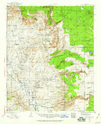
~ Camp Verde AZ topo map, 1:125000 scale, 30 X 30 Minute, Historical, 1932, updated 1959
Camp Verde, Arizona, USGS topographic map dated 1932.
Includes geographic coordinates (latitude and longitude). This topographic map is suitable for hiking, camping, and exploring, or framing it as a wall map.
Printed on-demand using high resolution imagery, on heavy weight and acid free paper, or alternatively on a variety of synthetic materials.
Topos available on paper, Waterproof, Poly, or Tyvek. Usually shipping rolled, unless combined with other folded maps in one order.
- Product Number: USGS-5549308
- Free digital map download (high-resolution, GeoPDF): Camp Verde, Arizona (file size: 9 MB)
- Map Size: please refer to the dimensions of the GeoPDF map above
- Weight (paper map): ca. 55 grams
- Map Type: POD USGS Topographic Map
- Map Series: HTMC
- Map Verison: Historical
- Cell ID: 320659
- Scan ID: 315335
- Imprint Year: 1959
- Woodland Tint: Yes
- Survey Year: 1932
- Datum: NAD27
- Map Projection: Polyconic
- Map published by United States Geological Survey
- Map Language: English
- Scanner Resolution: 600 dpi
- Map Cell Name: Camp Verde
- Grid size: 30 X 30 Minute
- Date on map: 1932
- Map Scale: 1:125000
- Geographical region: Arizona, United States
Neighboring Maps:
All neighboring USGS topo maps are available for sale online at a variety of scales.
Spatial coverage:
Topo map Camp Verde, Arizona, covers the geographical area associated the following places:
- Aultman - Munds Park - Lawrence Crossing - Country Estates - Lake Montezuma - Indian Gardens - Mesa Verde Estates - Oak Creek Mobilodge - Cornville - Flower Pot - Security Acres - Clear Creek - Bignotti - Verde - Mountain View Estates - Baldwins Crossing - Buffalo Run Mobile Home Park - Fort Verde Estates - Paradise Acres - Stoneman Lake - Jordan - Tres Rios - Jordan Meadows - Smelter City - White Hills Mobile Home Park - Rimrock - Wingfield - West Sedona - The Willows at Camp Verde Mobile Home Park - Sunset Village Mobile Home Park - Camp Verde - Reddells Ranch Acres - Bridgeport - Pioneer Acres - Sedona Shadows Mobile Home Park - Oak Creek - Red Rock - Fort River Caves - Middle Verde - Page Springs - Rainbow Trailer Park - Camp Verde Mobile Home Park - Sedona - Verde River Meadows One - McGuireville - Big Park
- Map Area ID: AREA3534.5-112-111.5
- Northwest corner Lat/Long code: USGSNW35-112
- Northeast corner Lat/Long code: USGSNE35-111.5
- Southwest corner Lat/Long code: USGSSW34.5-112
- Southeast corner Lat/Long code: USGSSE34.5-111.5
- Northern map edge Latitude: 35
- Southern map edge Latitude: 34.5
- Western map edge Longitude: -112
- Eastern map edge Longitude: -111.5


