
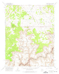
~ Tuckup Canyon AZ topo map, 1:62500 scale, 15 X 15 Minute, Historical, 1962, updated 1974
Tuckup Canyon, Arizona, USGS topographic map dated 1962.
Includes geographic coordinates (latitude and longitude). This topographic map is suitable for hiking, camping, and exploring, or framing it as a wall map.
Printed on-demand using high resolution imagery, on heavy weight and acid free paper, or alternatively on a variety of synthetic materials.
Topos available on paper, Waterproof, Poly, or Tyvek. Usually shipping rolled, unless combined with other folded maps in one order.
- Product Number: USGS-5548882
- Free digital map download (high-resolution, GeoPDF): Tuckup Canyon, Arizona (file size: 7 MB)
- Map Size: please refer to the dimensions of the GeoPDF map above
- Weight (paper map): ca. 55 grams
- Map Type: POD USGS Topographic Map
- Map Series: HTMC
- Map Verison: Historical
- Cell ID: 63728
- Scan ID: 315128
- Imprint Year: 1974
- Woodland Tint: Yes
- Aerial Photo Year: 1960
- Field Check Year: 1962
- Datum: NAD27
- Map Projection: Polyconic
- Map published by United States Geological Survey
- Map Language: English
- Scanner Resolution: 600 dpi
- Map Cell Name: Tuckup Canyon
- Grid size: 15 X 15 Minute
- Date on map: 1962
- Map Scale: 1:62500
- Geographical region: Arizona, United States
Neighboring Maps:
All neighboring USGS topo maps are available for sale online at a variety of scales.
Spatial coverage:
Topo map Tuckup Canyon, Arizona, covers the geographical area associated the following places:
- Hancock Knoll - Pocket Point - Hitson Tank - Kanab Plateau - Boysag Point Arch - Hotel Spring - Tule Spring - Fern Glen Canyon - Hades Knoll - Dome Trail - June Heaton Tank - Cottonwood Canyon - National Canyon - Hancock Knolls - White Tank - Nininger Tank - Buckhorn Spring - Havasu Rapids - Dome Pocket - Willow Canyon - Cottonwood Spring - Tuckup Rocky Point - School Section Tank - Havasu Canyon - Tuckup Trail - Fern Glen Rapids - Havasu Creek - Tuckup Canyon - Willow Spring - S B Point - Cork Spring - Conglomerate Arch - Big Point - Dome Spring - Cable Crossing (historical) - Little Joe Spring - Yumtheska Point - Big Jackson Tank - Hundred and Sixtyfour Mile Rapids - Gump Tank - North Fork Robinson Wash - Merle Findlay Tank - The Dome - The Cork - Schmutz Spring - Flatiron Butte - Alamo Window
- Map Area ID: AREA36.536.25-113-112.75
- Northwest corner Lat/Long code: USGSNW36.5-113
- Northeast corner Lat/Long code: USGSNE36.5-112.75
- Southwest corner Lat/Long code: USGSSW36.25-113
- Southeast corner Lat/Long code: USGSSE36.25-112.75
- Northern map edge Latitude: 36.5
- Southern map edge Latitude: 36.25
- Western map edge Longitude: -113
- Eastern map edge Longitude: -112.75


