
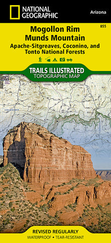


Mogollon Rim and Munds Mountain Wilderness Areas, Map 855 by National Geographic Maps
Waterproof, tear-resistant, topographic map. Designed to be easy-to-read, yet highly detailed, this map includes a comprehensive road and trail network distinguishing between major, secondary, high-clearance, OHV routes, hiking, horse, biking, multi-use, motorized and non-motorized trails. All forest roads are labeled with their official road number and trails are clearly identified with their given name. Boundaries are color-coded and clearly shown for National Forest, National Monument, Ranger District, Wilderness Areas, State Park, State Wildlife Areas, Department of Defense, and Indian Reservation lands. Additionally, Arizona Game Management Unit (GMU) boundaries and public and private lands are clearly identified.
An extensive collection of important and unique locations are pinpointed on the map including: visitor centers, campgrounds, picnic facilities, parking areas, RV dump sites, interpretive trails, trailheads, gates, river access sites, river mileages, swimming holes, lookout towers, viewpoints, museums, and Sno-Parks.
Every National Geographic Trails Illustrated map is an essential tool for safely navigating the backcountry with GPS or compass as they are clearly marked with both Latitude/Longitude and UTM coordinate grids, compass rose with magnetic declination, scale bar, and full legend.
Some of the places shown on the west side of the Mogollon Rim / Munds Mountain map include: Coconino National Forest, Munds Mountain Wilderness, Wet Beaver Wilderness, West Clear Creek Wilderness, Fossil Springs Wilderness, Sedona, Lake Montezuma, Verde Wild and Scenic River, Mogollon Rim, Arizona Trail, and more.
The east side of the map features: Coconino National Forest, Apache Sitgreaves National Forest, Arizona Trail, Mogollon Plateau, and more.
This Trails Illustrated map is printed in the U.S.A. on a durable synthetic paper, making it waterproof, tear-resistant, and capable for withstanding any condition mother nature can dish out. Double-sided.
- Product Number: 2053318M
- Product Code: TI_MOGOLLON
- Publisher Product ID: TI00000855
- ISBN: 9781566955140
- Year of Publication: 2010
- Folded Size: 9.45 x 4.33 inches
- Unfolded Size: 37.01 x 24.8 inches
- Map type: Folded Map
- Geographical region: Arizona


