
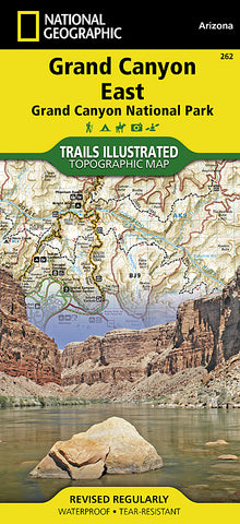
Grand Canyon, East, Map 262 by National Geographic Maps
• Waterproof • Tear-Resistant • Topographic Map
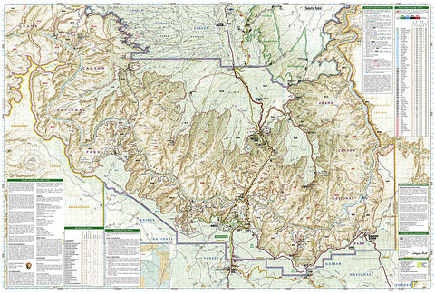
Grand Canyon East (#262) and Grand Canyon West (#263) combine to cover the entire Grand Canyon National Park and its bordering public lands. Both maps contain detailed and easy-to-read trail and road networks, locations of facilities, points of interest, and highly accurate terrain with thousands of feature names. Official Grand Canyon Backcountry Use Areas are shown, coded by degree of experience required. Suggested hikes and itineraries, important park regulations, safety tips and contact information make these maps an invaluable resource.
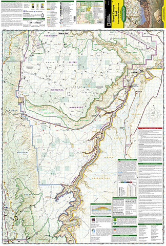
Grand Canyon East (#262) contains detailed coverage from the parks northeastern boundary at Glen Canyon to the highly visited areas just west of Grand Canyon village on the south rim (Colorado River miles 0 - 142).
Features Included:
Colorado River Miles 0-142, South Rim Visitor Center, Grand Canyon Village, Route 64 Desert View Drive, North Rim Visitor Center, Route 67, Marble Canyon, Paria Canyon, Vermillion Cliffs National Monument, Paria Canyon Wilderness, Coyote Buttes, House Rock Wildlife Area, Kaibab National Forest, Saddle Mountain Wilderness, Grand Canyon Game Preserve, Coconino Plateau, Arizona Trail, Great Western Trail, and more.
Grand Canyon West (#263) slightly overlaps with Grand Canyon East and contains detailed coverage from the high visitation areas just west of the Grand Canyon Visitor Center to the western boundary of the park at Lake Mead. (Colorado River miles 110-278).
Map Scale = 1:90,000
- Product Number: 2034530M
- Product Code: TI_GRAND_CA_E
- Publisher Product ID: TI00000262
- ISBN: 9781566954945
- Year of Publication: 2009
- Folded Size: 9.45 x 4.33 inches
- Unfolded Size: 24.8 x 33.07 inches
- Map type: Folded Map
- Geographical region: Arizona


