
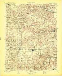
~ Palmyra MO topo map, 1:125000 scale, 30 X 30 Minute, Historical, 1903
Palmyra, Missouri, USGS topographic map dated 1903.
Includes geographic coordinates (latitude and longitude). This topographic map is suitable for hiking, camping, and exploring, or framing it as a wall map.
Printed on-demand using high resolution imagery, on heavy weight and acid free paper, or alternatively on a variety of synthetic materials.
Topos available on paper, Waterproof, Poly, or Tyvek. Usually shipping rolled, unless combined with other folded maps in one order.
- Product Number: USGS-8618614
- Free digital map download (high-resolution, GeoPDF): Palmyra, Missouri (file size: 8 MB)
- Map Size: please refer to the dimensions of the GeoPDF map above
- Weight (paper map): ca. 55 grams
- Map Type: POD USGS Topographic Map
- Map Series: HTMC
- Map Verison: Historical
- Cell ID: 66275
- Scan ID: 325545
- Survey Year: 1901
- Datum: Unstated
- Map Projection: Unstated
- Map published by United States Geological Survey
- Map Language: English
- Scanner Resolution: 600 dpi
- Map Cell Name: Palmyra
- Grid size: 30 X 30 Minute
- Date on map: 1903
- Map Scale: 1:125000
- Geographical region: Missouri, United States
Neighboring Maps:
All neighboring USGS topo maps are available for sale online at a variety of scales.
Spatial coverage:
Topo map Palmyra, Missouri, covers the geographical area associated the following places:
- Argola - Bellville - Clapper - Burksville - Smileyville - Slees Mills - Spalding - Huntington - Goss - Warren - Hatch - Hester - Hassard - The Landing - Emerson - Durham - Barkley - Woodland - Palmyra - Philadelphia - Newark - Kendall - Cherry Dell (historical) - Joanna - Dodge City - Hunnewell - Lakenan - North Fork - Heather - Steffenville - Maywood - Leich Ford - Indian Creek - Monroe City - Rensselaer - Newmarket - Taylor - Ely - Emden - Naomi - Little Union - Stoutsville - Center - Elgin - Nelsonville - Benbow - Cincinnati - Sigsbee - Sharpsburg - Oakdale - West Ely - Shaver Ford - Sheil
- Map Area ID: AREA4039.5-92-91.5
- Northwest corner Lat/Long code: USGSNW40-92
- Northeast corner Lat/Long code: USGSNE40-91.5
- Southwest corner Lat/Long code: USGSSW39.5-92
- Southeast corner Lat/Long code: USGSSE39.5-91.5
- Northern map edge Latitude: 40
- Southern map edge Latitude: 39.5
- Western map edge Longitude: -92
- Eastern map edge Longitude: -91.5


