
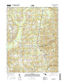
~ Hughesville MD topo map, 1:24000 scale, 7.5 X 7.5 Minute, 2016
Hughesville, Maryland, USGS topographic map dated 2016.
Includes geographic coordinates (latitude and longitude). This topographic map is suitable for hiking, camping, and exploring, or framing it as a wall map.
Printed on-demand using high resolution imagery, on heavy weight and acid free paper, or alternatively on a variety of synthetic materials.
Topos available on paper, Waterproof, Poly, or Tyvek. Usually shipping rolled, unless combined with other folded maps in one order.
- Product Number: USGS-8566478
- Free digital map download (high-resolution, GeoPDF): Hughesville, Maryland (file size: 29 MB)
- Map Size: please refer to the dimensions of the GeoPDF map above
- Weight (paper map): ca. 55 grams
- Map Type: POD USGS Topographic Map
- Map Series: US Topo
- Map Verison: Current
- Cell ID: 21402
- Datum: North American Datum of 1983
- Map Projection: Transverse Mercator
- Map Cell Name: Hughesville
- Grid size: 7.5 X 7.5 Minute
- Date on map: 2016
- Map Scale: 1:24000
- Geographical region: Maryland, United States
Neighboring Maps:
All neighboring USGS topo maps are available for sale online at a variety of scales.
Spatial coverage:
Topo map Hughesville, Maryland, covers the geographical area associated the following places:
- Green Spring - Sunnyside - Ridgeview - Oak Estates - Masons - Park Estates - Knolland - Bryantown Hills - Hidden Valley - Karen Knolls - Kindy Hook - Forest Glen Estates - Forest Park - Breezy Knolls - Carrico Mill Estates - Malcolm - Forest Estates - Independence Village - Gallant Green Woods - Underwood (historical) - Zekiah Valley - Bryantown - Bellewood - Meadowbrook - Mandleys - Hughesville Manor - Serenity Woods - Sandy Level Estates - Sylvanhurst - Belle Ridge Farms - Plainview Gardens - Clayton Run Estates - Pine Grove Estates - Bowen Estates - Grosstown - Gallant Acres - Bryantown Estates - Three Brothers - Briar Ridge - Charles County Gardens - Meadow Creek Manor - Walnut Hills - Edelen Estates - Hickory Thicket - Hughesville - Oakland Acres - Hunters Farms - Woodridge Acres - Cameron Ridge - North Indian Creek Estates
- Map Area ID: AREA38.62538.5-76.875-76.75
- Northwest corner Lat/Long code: USGSNW38.625-76.875
- Northeast corner Lat/Long code: USGSNE38.625-76.75
- Southwest corner Lat/Long code: USGSSW38.5-76.875
- Southeast corner Lat/Long code: USGSSE38.5-76.75
- Northern map edge Latitude: 38.625
- Southern map edge Latitude: 38.5
- Western map edge Longitude: -76.875
- Eastern map edge Longitude: -76.75


