
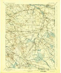
~ Mount Holly NJ topo map, 1:62500 scale, 15 X 15 Minute, Historical, 1898, updated 1924
Mount Holly, New Jersey, USGS topographic map dated 1898.
Includes geographic coordinates (latitude and longitude). This topographic map is suitable for hiking, camping, and exploring, or framing it as a wall map.
Printed on-demand using high resolution imagery, on heavy weight and acid free paper, or alternatively on a variety of synthetic materials.
Topos available on paper, Waterproof, Poly, or Tyvek. Usually shipping rolled, unless combined with other folded maps in one order.
- Product Number: USGS-8527058
- Free digital map download (high-resolution, GeoPDF): Mount Holly, New Jersey (file size: 7 MB)
- Map Size: please refer to the dimensions of the GeoPDF map above
- Weight (paper map): ca. 55 grams
- Map Type: POD USGS Topographic Map
- Map Series: HTMC
- Map Verison: Historical
- Cell ID: 58014
- Scan ID: 255283
- Imprint Year: 1924
- Survey Year: 1885
- Datum: NAD
- Map Projection: Polyconic
- Map published by United States Geological Survey
- Map Language: English
- Scanner Resolution: 600 dpi
- Map Cell Name: Mount Holli
- Grid size: 15 X 15 Minute
- Date on map: 1898
- Map Scale: 1:62500
- Geographical region: New Jersey, United States
Neighboring Maps:
All neighboring USGS topo maps are available for sale online at a variety of scales.
Spatial coverage:
Topo map Mount Holly, New Jersey, covers the geographical area associated the following places:
- Birchfield - Jackson - Marlboro - Atco - Dicktown - Point of Woods - Charleston East - Shinntown - Pheasant Run - Pipers Corner - Newbolds Corner - Stanwick - Kingston Estates - Cinnaminson - West Moorestown - Fostertown - Birchwood Lakes - Haines Corner - Clementon - Woodstream - Rancocas Heights - New Freedom - Marlton - Albion - Braddocks Mill - Evans Corner - Kirkwood - Evesboro - Masonville - Penbryn - Lake Pine - Springdale - Clermont - Lippincotts Corner - Cropwell - Locust Grove - Medford - Maple Shade - Taunton Lake - Moorestown - Mount Laurel - Ivywood - Pine Grove - East Berlin - Gibbsboro - Reed Crossing - Oliphants Mills - Lucaston - Hainesport - Willowdale - Colestown - Willow Ridge - Glendale - Stanwick Glen - Cherry Downs - Eayrestown - Heritage Village - Mount Holly - Louden - Lumberton - Centerton - Berlin Heights - Surrey Place - Coxs Corner - Kirbys Mill - Hartford - Wrightsville - Chairville - Barclay Farm - Berlin - Christopher Mills - Lenola - Alluvium - Greentree - Kresson - Deer Park - Woodcrest - Cherry Valley - Flyat - The Maples - Hoot Owl Estates - Fellowship - Crowfoot - Echelon - Overbrook - Ramblewood - Melrose - Deerwoods - Cambridge - Bougher - Oakwood Lakes - Medford Lakes - Candlewyck - West Berlin - Greentree Village - Meadowbrook - Fox Hollow Woods - Tomlinson Mill - Colemantown - Pine Hill
- Map Area ID: AREA4039.75-75-74.75
- Northwest corner Lat/Long code: USGSNW40-75
- Northeast corner Lat/Long code: USGSNE40-74.75
- Southwest corner Lat/Long code: USGSSW39.75-75
- Southeast corner Lat/Long code: USGSSE39.75-74.75
- Northern map edge Latitude: 40
- Southern map edge Latitude: 39.75
- Western map edge Longitude: -75
- Eastern map edge Longitude: -74.75


