
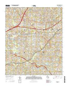
~ Luxomni GA topo map, 1:24000 scale, 7.5 X 7.5 Minute, Current, 2014
Luxomni, Georgia, USGS topographic map dated 2014.
Includes geographic coordinates (latitude and longitude). This topographic map is suitable for hiking, camping, and exploring, or framing it as a wall map.
Printed on-demand using high resolution imagery, on heavy weight and acid free paper, or alternatively on a variety of synthetic materials.
Topos available on paper, Waterproof, Poly, or Tyvek. Usually shipping rolled, unless combined with other folded maps in one order.
- Product Number: USGS-7539958
- Free digital map download (high-resolution, GeoPDF): Luxomni, Georgia (file size: 37 MB)
- Map Size: please refer to the dimensions of the GeoPDF map above
- Weight (paper map): ca. 55 grams
- Map Type: POD USGS Topographic Map
- Map Series: US Topo
- Map Verison: Current
- Cell ID: 26993
- Datum: North American Datum of 1983
- Map Projection: Transverse Mercator
- Map Cell Name: Luxomni
- Grid size: 7.5 X 7.5 Minute
- Date on map: 2014
- Map Scale: 1:24000
- Geographical region: Georgia, United States
Neighboring Maps:
All neighboring USGS topo maps are available for sale online at a variety of scales.
Spatial coverage:
Topo map Luxomni, Georgia, covers the geographical area associated the following places:
- Stone Mill - River Colony - Cricket Hill - Plantation Woods - Steeplechase - Hanarry Estates - Brookwood Manor - Heritage Station - Yorktown - Five Forks - Regal Estates - Castle Courts - Luxomni - Fairview Station - Jackson Township - Flowers Crossing - Broxton Woods - Pleasant Acres - La Mancha - Oakland North - Ansley Brook - Fairfield Farms - Inglenook - Bethesda - Rolling Ridge - Burnt Creek - River Oak - Murphyville - Murphy Estates - River Bridge - Summerville - Purcell Valley - Bridgewater - Hunting Creek - Marsh Creek - Cotton Creek - Pleasant Hill - The Wildings - Bristol Downs - Sweet Water - Rambling Woods - Meadow - Countryside Village Mobile Home Park - Friendly Village of Crooked Creek - Regency Woods - Coopers Pond - Gloster - Sioux Acres Mobile Home Park - Emerald Forest - Lester Woods - Oakbrook Forest
- Map Area ID: AREA3433.875-84.125-84
- Northwest corner Lat/Long code: USGSNW34-84.125
- Northeast corner Lat/Long code: USGSNE34-84
- Southwest corner Lat/Long code: USGSSW33.875-84.125
- Southeast corner Lat/Long code: USGSSE33.875-84
- Northern map edge Latitude: 34
- Southern map edge Latitude: 33.875
- Western map edge Longitude: -84.125
- Eastern map edge Longitude: -84


