
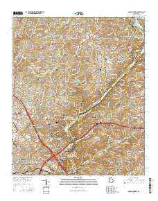
~ Sandy Springs GA topo map, 1:24000 scale, 7.5 X 7.5 Minute, Current, 2014
Sandy Springs, Georgia, USGS topographic map dated 2014.
Includes geographic coordinates (latitude and longitude). This topographic map is suitable for hiking, camping, and exploring, or framing it as a wall map.
Printed on-demand using high resolution imagery, on heavy weight and acid free paper, or alternatively on a variety of synthetic materials.
Topos available on paper, Waterproof, Poly, or Tyvek. Usually shipping rolled, unless combined with other folded maps in one order.
- Product Number: USGS-7536811
- Free digital map download (high-resolution, GeoPDF): Sandy Springs, Georgia (file size: 41 MB)
- Map Size: please refer to the dimensions of the GeoPDF map above
- Weight (paper map): ca. 55 grams
- Map Type: POD USGS Topographic Map
- Map Series: US Topo
- Map Verison: Current
- Cell ID: 39847
- Datum: North American Datum of 1983
- Map Projection: Transverse Mercator
- Map Cell Name: Sandy Springs
- Grid size: 7.5 X 7.5 Minute
- Date on map: 2014
- Map Scale: 1:24000
- Geographical region: Georgia, United States
Neighboring Maps:
All neighboring USGS topo maps are available for sale online at a variety of scales.
Spatial coverage:
Topo map Sandy Springs, Georgia, covers the geographical area associated the following places:
- Country Park - Riverhill - Post Harbor - Cumberland Hill - Riverwood - Valencia Hill - Chimney Trace - The Highlands at Akers - Postwoods - Waterford - Hampton Lake - Seven Springs - Oaks of Cumberland - Crossgate - The Courtyards - River Chase - Salem Woods - Lake Island Estates - Rose Garden Hills - Princeton Lakes - Indian Hills - Sibley Forest - Stonewall - Treetop - Farmstead - Chattahoochee Heights - Shadowwood - Seborn - Tuxedo Estates - Riverside - Sandy Springs - Terrell Mill Estates - Misty Ridge - Montwicke - The Oaks - Glencastle Estates - Chattahoochee Plantation - Idlewood Vally - Heritage Glen - East Conway Hill - Blakeford - Cumberland Bridge - Villa Chase - Glen Errol - Post River - Sun Valley - Powers Ferry Vantage - Countryside at Cumberland - Cameron Glen - The Highlands - Laurel Brook - Coldstream - Hampton Farms - McIvor (historical) - Ashebrook - Greyfield - Mount Bethel - The Columns - Lake Colony - Heritage - Forest Brook - Millridge - Powers Lane - Woodmere - Millbrook - Princeton Walk - Northwest Park
- Map Area ID: AREA3433.875-84.5-84.375
- Northwest corner Lat/Long code: USGSNW34-84.5
- Northeast corner Lat/Long code: USGSNE34-84.375
- Southwest corner Lat/Long code: USGSSW33.875-84.5
- Southeast corner Lat/Long code: USGSSE33.875-84.375
- Northern map edge Latitude: 34
- Southern map edge Latitude: 33.875
- Western map edge Longitude: -84.5
- Eastern map edge Longitude: -84.375


