
~ Mount Pisgah OR topo map, 1:24000 scale, 7.5 X 7.5 Minute, Current, 2014
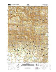
Mount Pisgah, Oregon, USGS topographic map dated 2014.
Includes geographic coordinates (latitude and longitude). This topographic map is suitable for hiking, camping, and exploring, or framing it as a wall map.
Printed on-demand using high resolution imagery, on heavy weight and acid free paper, or alternatively on a variety of synthetic materials.
Topos available on paper, Waterproof, Poly, or Tyvek. Usually shipping rolled, unless combined with other folded maps in one order.
- Product Number: USGS-7253484
- Free digital map download (high-resolution, GeoPDF): Mount Pisgah, Oregon (file size: 38 MB)
- Map Size: please refer to the dimensions of the GeoPDF map above
- Weight (paper map): ca. 55 grams
- Map Type: POD USGS Topographic Map
- Map Series: US Topo
- Map Verison: Current
- Cell ID: 30756
- Datum: North American Datum of 1983
- Map Projection: Transverse Mercator
- Map Cell Name: Mount Pisgah
- Grid size: 7.5 X 7.5 Minute
- Date on map: 2014
- Map Scale: 1:24000
- Geographical region: Oregon, United States
Neighboring Maps:
All neighboring USGS topo maps are available for sale online at a variety of scales.
Spatial coverage:
Topo map Mount Pisgah, Oregon, covers the geographical area associated the following places:
- Bridge Spring - North Point - Mount Pisgah - Dent Spring - Shady Creek - Yellowjacket Reservoir - Hoffman Spring - Bug Creek - West Fork Fox Creek - Masterson Spring - Mud Spring - Allen Creek Horse Camp - North Pisgah Spring - Badger Cabin - Wineburger Camp - Scotts Recreation Site - Maxwell Creek - Milk Spring - East Point - Ross Reservoir - Stump Creek - Bridge Creek Wilderness - Allen Creek Dam - East Fork Elliot Creek - Slow Spring - Nelson Spring - Pisgah Spring - Crosswhite Creek - Maxwell Reservoir - Carrol Campground - Fox Creek - Maxwell Spring - Hemp Spring - Allen Creek Reservoir - Beetle Creek - Wolf Spring - Yellowjacket Creek
- Map Area ID: AREA44.544.375-120.25-120.125
- Northwest corner Lat/Long code: USGSNW44.5-120.25
- Northeast corner Lat/Long code: USGSNE44.5-120.125
- Southwest corner Lat/Long code: USGSSW44.375-120.25
- Southeast corner Lat/Long code: USGSSE44.375-120.125
- Northern map edge Latitude: 44.5
- Southern map edge Latitude: 44.375
- Western map edge Longitude: -120.25
- Eastern map edge Longitude: -120.125


