
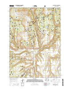
~ Hughet Valley OR topo map, 1:24000 scale, 7.5 X 7.5 Minute, Current, 2014
Hughet Valley, Oregon, USGS topographic map dated 2014.
Includes geographic coordinates (latitude and longitude). This topographic map is suitable for hiking, camping, and exploring, or framing it as a wall map.
Printed on-demand using high resolution imagery, on heavy weight and acid free paper, or alternatively on a variety of synthetic materials.
Topos available on paper, Waterproof, Poly, or Tyvek. Usually shipping rolled, unless combined with other folded maps in one order.
- Product Number: USGS-7252822
- Free digital map download (high-resolution, GeoPDF): Hughet Valley, Oregon (file size: 34 MB)
- Map Size: please refer to the dimensions of the GeoPDF map above
- Weight (paper map): ca. 55 grams
- Map Type: POD USGS Topographic Map
- Map Series: US Topo
- Map Verison: Current
- Cell ID: 72402
- Datum: North American Datum of 1983
- Map Projection: Transverse Mercator
- Map Cell Name: Hughet Valley
- Grid size: 7.5 X 7.5 Minute
- Date on map: 2014
- Map Scale: 1:24000
- Geographical region: Oregon, United States
Neighboring Maps:
All neighboring USGS topo maps are available for sale online at a variety of scales.
Spatial coverage:
Topo map Hughet Valley, Oregon, covers the geographical area associated the following places:
- J L Spring - Deer Cave Canyon - Upper West Fork Reservoir - Blue Creek Work Center - Calon Ranch - Carlon Spring - Blue Creek Spring - Ramsey Ranch - Mosier Spring - Turner Ranch - East Fork Reservoir - Basin Reservoir - Middle Fork Reservoir - Yellowjacket Trail - Gunther Reservoir - No Name Reservoir - Carlson Canyon - Stinger Creek - Gunther Creek - Beaverdam Reservoir - Hunter Spring - West Fork Reservoir - Dunn Ranch - Emigrant Reservoir - Dicks Reservoir - Blue Creek - Dead Mule Spring - Beaverdam Trail - Dead Mule Reservoir - Spring Creek - Seven Up Spring - Lower Buttes Reservoir - Campbell Ranch - Ramsey Spring - Rocking Bar Spring - Sawtooth Creek - Finke Spring - Hughet Valley - Professor Spring - Gunther Spring - Dead Mule Canyon - Willow Reservoir - Hughet Creek - Cricket Creek - Beaverdam Creek - Smith Reservoir - Spring Creek Spring - East Fork Blue Creek - Pine Knoll Basin
- Map Area ID: AREA43.87543.75-119.375-119.25
- Northwest corner Lat/Long code: USGSNW43.875-119.375
- Northeast corner Lat/Long code: USGSNE43.875-119.25
- Southwest corner Lat/Long code: USGSSW43.75-119.375
- Southeast corner Lat/Long code: USGSSE43.75-119.25
- Northern map edge Latitude: 43.875
- Southern map edge Latitude: 43.75
- Western map edge Longitude: -119.375
- Eastern map edge Longitude: -119.25


