
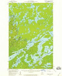
~ Basswood Lake MN topo map, 1:62500 scale, 15 X 15 Minute, Historical, 1957, updated 1959
Basswood Lake, Minnesota, USGS topographic map dated 1957.
Includes geographic coordinates (latitude and longitude). This topographic map is suitable for hiking, camping, and exploring, or framing it as a wall map.
Printed on-demand using high resolution imagery, on heavy weight and acid free paper, or alternatively on a variety of synthetic materials.
Topos available on paper, Waterproof, Poly, or Tyvek. Usually shipping rolled, unless combined with other folded maps in one order.
- Product Number: USGS-5996374
- Free digital map download (high-resolution, GeoPDF): Basswood Lake, Minnesota (file size: 3 MB)
- Map Size: please refer to the dimensions of the GeoPDF map above
- Weight (paper map): ca. 55 grams
- Map Type: POD USGS Topographic Map
- Map Series: HTMC
- Map Verison: Historical
- Cell ID: 50997
- Scan ID: 804463
- Imprint Year: 1959
- Woodland Tint: Yes
- Aerial Photo Year: 1956
- Field Check Year: 1957
- Datum: NAD27
- Map Projection: Polyconic
- Map published by United States Geological Survey
- Map Language: English
- Scanner Resolution: 508 dpi
- Map Cell Name: Basswood Lake
- Grid size: 15 X 15 Minute
- Date on map: 1957
- Map Scale: 1:62500
- Geographical region: Minnesota, United States
Neighboring Maps:
All neighboring USGS topo maps are available for sale online at a variety of scales.
Spatial coverage:
Topo map Basswood Lake, Minnesota, covers the geographical area associated the following places:
- Wednesday Bay - Jackfish Lake - Basswood River - Pipestone Bay - Wheelbarrow Falls - Frolic Lake - Half Dog Island - Hoist Bay - Good Lake - Basswood Falls - Section Sixteen Lake - Wegens Point - Muskeg Creek - Washte Lake - Wind Lake - Wind Lake - Basswood Lake - Quetco Wilderness Research Center - Horse River - Indiana Lake - Lewis Narrows - Acorn Lake - Jackfish Bay - Picture Rock - Hube Lake - Back Bay - New York Island - United States Point - Caribou Point - Canoe Island - Table Rock - Circle Lake - Squirrel Island - Last Falls - Pipestone Falls - Good Creek - Indian Grave Island - Washington Island - Sauna Lake - Lincoln Island - Azion Lake - Wind Lake Dam - Wabosons Lake - Gary Island - Sash Lake - Lower Basswood Falls - Wind Bay - Norway Island - Hausons Island
- Map Area ID: AREA48.2548-91.75-91.5
- Northwest corner Lat/Long code: USGSNW48.25-91.75
- Northeast corner Lat/Long code: USGSNE48.25-91.5
- Southwest corner Lat/Long code: USGSSW48-91.75
- Southeast corner Lat/Long code: USGSSE48-91.5
- Northern map edge Latitude: 48.25
- Southern map edge Latitude: 48
- Western map edge Longitude: -91.75
- Eastern map edge Longitude: -91.5


