
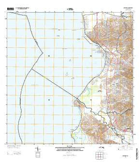
~ Mayaguez PR topo map, 1:20000 scale, 7.5 X 7.5 Minute, Historical, 2013
Mayaguez, Puerto Rico, USGS topographic map dated 2013.
Includes geographic coordinates (latitude and longitude). This topographic map is suitable for hiking, camping, and exploring, or framing it as a wall map.
Printed on-demand using high resolution imagery, on heavy weight and acid free paper, or alternatively on a variety of synthetic materials.
Topos available on paper, Waterproof, Poly, or Tyvek. Usually shipping rolled, unless combined with other folded maps in one order.
- Product Number: USGS-5964546
- Free digital map download (high-resolution, GeoPDF): Mayaguez, Puerto Rico (file size: 27 MB)
- Map Size: please refer to the dimensions of the GeoPDF map above
- Weight (paper map): ca. 55 grams
- Map Type: POD USGS Topographic Map
- Map Series: US Topo
- Map Verison: Historical
- Cell ID: 28115
- Datum: North American Datum of 1983
- Map Projection: Transverse Mercator
- Map Cell Name: Mayaguez
- Grid size: 7.5 X 7.5 Minute
- Date on map: 2013
- Map Scale: 1:20000
- Geographical region: Puerto Rico, United States
Neighboring Maps:
All neighboring USGS topo maps are available for sale online at a variety of scales.
Spatial coverage:
Topo map Mayaguez, Puerto Rico, covers the geographical area associated the following places:
- Ramirez de Arellano - San Miguel - Segundo Castillo - Sábalos - Plan Bonito - Celitos - Guanaiibo - Vivaldi - Yaguez - Llavit - Mansiones de Espana - Parcelas Lomas Verdes - Guanajiro Homes - Villa Sol - Hoya Grande - Jmari Ramos - Pena - Cornelia - Hormigueros - Flamboyan - Columbus Landing - Cerrillos - San José - Villa Sultana - Sector Trastalleres - Quintas de San Francisco - San Jose - John F Kennedy - Santurce - Jardines de Mayaquez - Sector Dulces Labios - La Soledad - Cuesta de las Piedras - Ramirez Agrait - Roosevelt - Mayagüez - García - Buena Vista - Estebania - Malecón - Candelaria - San Benito - Pueblo Nuevo - Nieves Bonet - Sector Columbia - Belmonte - Marina - Maní - Mayagüez Terrace - Nadal - Guanajibo Castillo - Ensanche Martinez - Cuebas - Archilla Cabrena - Carcel - Barcelona - Domingo Ortiz - Miramar - Lomas Lindas - Vista del Oeste - Mayagüez Zona Urbana - Peña Cortada - Paris - Celitos - Balboa - Residencial Yaguez - Canterra - Santa Maria - Meridional - Vista Verde - Candelaria - Brisas de Mal - Paseo la Sultana
- Map Area ID: AREA18.2518.125-67.25-67.125
- Northwest corner Lat/Long code: USGSNW18.25-67.25
- Northeast corner Lat/Long code: USGSNE18.25-67.125
- Southwest corner Lat/Long code: USGSSW18.125-67.25
- Southeast corner Lat/Long code: USGSSE18.125-67.125
- Northern map edge Latitude: 18.25
- Southern map edge Latitude: 18.125
- Western map edge Longitude: -67.25
- Eastern map edge Longitude: -67.125


